WIKIPEDIA [NOT TO BE TRUSTED!] The Piri Reis map is a world map compiled in 1513 from military intelligence by the Ottoman admiral and cartographer Piri Reis (pronounced [piɾi ɾeis]). Approximately one third of the map survives; it shows the western coasts of Europe and North Africa and the coast of Brazil with reasonable accuracy. Various Atlantic islands, including the Azores and Canary Islands, are depicted, as is the mythical island of Antillia and possibly Japan. The map's historical importance lies in its demonstration of the extent of global exploration of the New World by approximately 1510, and in its claim to have used a map of Christopher Columbus, otherwise lost, as a source. Piri also stated that he had used ten Arab sources and four Indian maps sourced from the Portuguese. More recently, the map has been the focus of pseudohistoric claims for the pre-modern exploration of the Antarctic coast.
3. Gyroscope's always remaining level throughout worldwide aeroplane flight travel
4. Polaris never moves from its position despite earths travel through space
5. No measurable curvature
6. Terminator line on the moon during daytime often does not coincide with suns directional light
7. Gravity is simply buoyancy & density
8. No photographic evidence of satellites
9 . Questionable flight paths in southern hemisphere
10. Antarctic treaty forbids freedom of movement in Antarctic
11. Van Allen radiation belt makes space travel impossible
12. Water bubbles on ISS film footage
13. The Moon landing
14. The Sun & globe earth model contradictions
— FAIR USE NOTICE: These works by DORJE DAKA are for criticism, comment, news reporting, teaching, and research. All footage taken falls under ''fair use'' of the Digital Millennium Copyright Act (1998). Therefore, no breach of privacy or copyright has been committed.
This video may contain copyrighted material the use of which has not been specifically authorised by the copyright owner. This material is being made available within this transformative or derivative work for the purpose of education, commentary and criticism are being distributed without profit, and is believed to be "fair use" in accordance with Title 17 U.S.C. Section 107 Copyright Disclaimer Under Section 107 of the Copyright Act 1976, allowance is made for "fair use" for purposes such as criticism, comment, news reporting, teaching, scholarship, and research. Fair use is a use permitted by copyright statute that might otherwise be infringing. Non-profit, educational or personal use tips the balance in favour of fair use.
200 Proofs Earth is Not a Spinning Ball Please download, read and share my new FREE ebook: 200 Proofs Earth is Not a Spinning Ball! PDF This 35 page ebook full of photographs and diagrams is the perfect tool to help spark conversation and awaken your friends and family to the mother of all cons...
Please download, read and share my new FREE ebook: 200 Proofs Earth is Not a Spinning Ball! PDF This 35 page ebook full of photographs and diagrams is the perfect tool to help spark conversation and awaken your friends and family to the mother of all conspiracies. Please make copies, print, distribute, re-upload and do everything you can to get this most important information out to the masses!
International Flat Earth Research Society President Eric Dubay presents the complete history of Flat Earth from the beginning of recorded history to today. Please help share this most important presentation with as many as you can. Also please be sure to download and re-upload this and my other videos so they cannot censor us all. Thank so much to all my subscribers. For more information about our flat, motionless Earth visit: http://www.AtlanteanConspiracy.comhttp://www.IFERS.123.st
The figure of 24,900 miles is the diameter of the known world; the area which the light from the sun affects. Along the edge of our local area exists a massive 150 foot Ice Wall. The 150 foot Ice Wall is on the coast of Antarctica. The Ice Wall is a massive wall of ice that surrounds Antarctica. The shelf of ice is several hundred meters thick. This nearly vertical ice front to the open sea is more than 50 meters high above the water's surface. The Ice Wall was discovered by Sir James Clark Ross, a British Naval Officer and polar explorer who was among the first to venture to Antarctica in an attempt to determine the position of the South Magnetic Pole. Upon confronting the massive vertical front of of ice he famously remarked
    "It was ... an obstruction of such character as to leave no doubt in my mind as to our
    future proceedings, for we might as well sail through the cliffs of Dover as to penetrate
    such a mass.

    It would be impossible to conceive a more solid-looking mass of ice; not the smallest
    appearance of any rent or fissure could we discover throughout its whole extent, and the
    intensely bright sky beyond it but too plainly indicated the great distance to which it
    reached southward."

    -- Sir James Clark Ross
Sir James Clark Ross and his expeditionary fleet sailed around the Ice Wall for a number of months in circumnavigation. Between pit stops at the Cape of Good Hope and his polar expeditions, he spent the next several years of his life circumnavigating the southern coast vainly in search of a south sea passage to the other side. Beyond the 150 foot Ice Wall is anyone's guess. How far the ice extends; how it terminates; and what exists beyond it, are questions to which no present human experience can reply. All we at present know is, that snow and hail, howling winds, and indescribable storms and hurricanes prevail; and that in every direction "human ingress is barred by unsealed escarpments of perpetual ice," extending farther than eye or telescope can penetrate, and becoming lost in gloom and darkness. Some hold that the tundra of ice and snow stretches forever eternally.
Formation
The Ice Wall surrounds 95% of the Antarctic coast
The Ice Wall is a natural formation, a thick mass of floating ice that is attached to land, formed from and fed by tongues of glaciers extending outward from deep within the uncharted tundra into sheltered waters. Where there are no strong currents, the ice becomes partly grounded on the sea bottom and attaches itself to rocks and islands. The wall is pushed forward into the sea by glacial pressure until its forward growth is terminated. The entire coast of the Ice Wall is not one single complete wall, however. There are actually a series of thousand mile long walls, divided by Transantarctic Mountain Ranges up to 11,500 feet high. The weight of The Ice Walls are so enormous that they have literally pressed the land two thirds of a mile (one kilometer) into the earth. Under the massive forces of their own weight, the ice walls deform and drag themselves outward. Very large glaciers called ice streams flow through them continually, transporting ice from deep inland out to the sea.
Temperatures are thought to approach absolute zero the further one explores outwards. Exploration in this type of pitch black freezing environment is impossible for any man or machine. We live on a vast plane with an unknown diameter and an unknown depth. Dr. Samuel Birley Rowbotham held that knowing the true dimensions of the earth is something which will forever be unknowable by man.
Antarctic Coastal Types
Based on current manned exploration of Antarctica, the following table generalizes the frequency of the types of coasts found on the coastline:
Coastal types around Antarctica
Type
Frequency
Ice shelf (floating ice front)
44%
Ice walls (resting on ground)
38%
Ice stream/outlet glacier (ice front or ice wall)
13%
Rock
5%
Total
100%
Source: Drewry, D. J., ed. (1983). Antarctica: Glaciological and Geophysical Folio. Scott Polar Research Institute, University of Cambridge. ISBN 0901021040.
In this video I will discuss the firmament and something that comes up constantly within the Flat Earth topic...and that is Antarctica and the Antarctic Treaty...You can view this treaty on the U.S. Department of State's website in the link below. Antarctic
Bureau of Arms Control, Verification and Compliance
Signed at Washington December 1, 1959 Entered into force June 23, 1961 NarrativeTreaty Text
Narrative The Antarctic Treaty, the earliest of the post-World War II arms limitation agreements, has significance both in itself and as a precedent. It demilitarized the Antarctic Continent and provided for its cooperative exploration and future use. It has been cited as an example of nations exercising foresight and working in concert to prevent conflict before it develops. Based on the premise that to exclude armaments is easier than to eliminate or control them once they have been introduced, the treaty served as a model, in its approach and even in its specific provisions, for later "non-armament" treaties -- the treaties that excluded nuclear weapons from outer space, from Latin America, and from the seabed. By the 1950s, seven nations -- Argentina, Australia, Chile, France, New Zealand, Norway, and the United Kingdom -- claimed territorial sovereignty over areas of Antarctica. Claims of Argentina, Chile, and the United Kingdom overlapped. Eight other nations -- the United States, the Soviet Union, Belgium, Germany, Poland, Sweden, Japan, and South Africa -- had engaged in exploration but had put forward no specific claims. The United States did not recognize the claims of other governments and reserved the right to assert claims. The Soviet Union took a similar position.
Activities in the Antarctic had generally been conducted peacefully and cooperatively. Yet the possibility that exploitable economic resources might be found meant the possibility of future rivalry for their control. Moreover, isolated and uninhabited, the continent might at some time become a potential site for deploying nuclear weapons.
Fortunately, international scientific associations were able to work out arrangements for effective cooperation. In 1956 and 1957, for example, American meteorologists "wintered over" at the Soviet post Mirnyy, while Soviet meteorologists "wintered over" at Little America. These cooperative activities culminated in the International Geophysical Year of 1957-1958 (IGY), a joint scientific effort by 12 nations -- Argentina, Australia, Belgium, Chile, France, Japan, New Zealand, Norway, South Africa, the Soviet Union, the United Kingdom, and the United States -- to conduct studies of the Earth and its cosmic environment. In the years after World War II, as interest grew in keeping the continent from becoming militarized, there began diplomatic discussion of the possibility of formalizing a demilitarization arrangement. On May 3, 1958, the United States proposed to the other 11 nations participating in the IGY that a conference be held, based on the points of agreement that had been reached in informal discussions:
(1) that the legal status quo of the Antarctic Continent remain unchanged; (2) that scientific cooperation continue; (3) that the continent be used for peaceful purposes only.
All 11 nations accepted the U.S. invitation. The Washington Conference on Antarctica met from October 15 to December 1, 1959. No insurmountable conflicts or issues divided the conference, and negotiations culminated in a treaty signed by all 12 nations on December 1, 1959. After the U.S. Senate provided its advice and consent, the U.S. ratification was deposited on August 18, 1960, and the treaty entered into force on June 23, 1961, when the formal ratifications of all the participating nations had been deposited.
The treaty provides that Antarctica shall be used for peaceful purposes only. It specifically prohibits "any measures of a military nature, such as the establishment of military bases and fortifications, the carrying out of military maneuvers, as well as the testing of any type of weapons." (The Treaty does not prohibit the use of military personnel or equipment, however, for scientific research or for any other peaceful purpose.) Nuclear explosions and the disposal of radioactive waste material in Antarctica are prohibited.
The Treaty provides for designation of observers to carry out inspections in all areas of Antarctica, including all stations, installations and equipment, and ships and aircraft at discharge or embarkation points. Each observer has complete freedom of access at any time to any or all areas of Antarctica. Currently there are 50 Parties to the treaty, of whom 28 are Consultative Parties that participate in decision-making at Antarctic Treaty Consultative Meetings (ATCMs). Consultative Parties now include the original 12 Contracting Parties, as well as Brazil, Bulgaria, China, Ecuador, Finland, Germany, India, Italy, Republic of Korea, the Netherlands, Peru, Poland, Spain, Sweden, Ukraine, and Uruguay. The United States has conducted 14 inspections since 1963.
For the first time, in 2012 the U.S teamed with another country to conduct joint inspections of third-party Antarctic stations. In January 2012, a team of four officials from the United States and four from the Russian Federation inspected research facilities operated jointly by France and Italy (Concordia), Italy (Mario Zucchelli), and New Zealand (Scott Base). And in November-December 2012, a similar US-Russia team inspected which research facilities operated by Belgium (Princess Elisabeth Station), China (Zhongshan Station), India (Bharati and Maitri), Japan (Syowa), and Norway (Troll) – all in East Antarctica. A report of this second phase inspection will be presented jointly by the United States and Russia at the next Antarctic Treaty Consultative Meeting.
Thirty-five ATCMs have been held in accordance with Article IX of the Treaty, most recently in Australia in June 2012. Numerous recommendations and measures in furtherance of the principles and objectives of the Treaty have been adopted, many of which have now entered into force. The next ATCM will be in Brussels, Belgium in May 2013.
The Bureau of Oceans and International Environmental and Scientific Affairs coordinates U.S. efforts on Antarctic matters, and more information on U.S. Antarctic policy is available at: http://www.state.gov/e/oes/ocns/opa/c6528.htm For further information on U.S. Antarctic Treaty Inspections, see: http://www.state.gov/e/oes/ocns/opa/inspection/index.htm For the Secretary’s remarks commemorating the 50th Anniversary of the Antarctic Treaty see: http://www.state.gov/secretary/20092013clinton/rm/2009a/04/121314.htm Treaty Text The Antarctic Treaty Signed at Washington December 1, 1959Ratification advised by U.S. Senate August 10, 1960Ratified by U.S. President August 18, 1960U.S. ratification deposited at Washington August 18, 1960Proclaimed by U.S. President June 23, 1961Entered into force June 23, 1961 The Governments of Argentina, Australia, Belgium, Chile, the French Republic, Japan, New Zealand, Norway, the Union of South Africa, the Union of Soviet Socialist Republics, the United Kingdom of Great Britain and Northern Ireland, and the United States of America, Recognizing that it is in the interest of all mankind that Antarctica shall continue forever to be used exclusively for peaceful purposes and shall not become the scene or object of international discord; Acknowledging the substantial contributions to scientific knowledge resulting from international cooperation in scientific investigation in Antarctica; Convinced that the establishment of a firm foundation for the continuation and development of such cooperation on the basis of freedom of scientific investigation in Antarctica as applied during the International Geophysical Year accords with the interests of science and the progress of all mankind; Convinced also that a treaty ensuring the use of Antarctica for peaceful purposes only and the continuance of international harmony in Antarctica will further the purposes and principles embodied in the Charter of the United Nations; Have agreed as follows:
Article I 1. Antarctica shall be used for peaceful purposes only. There shall be prohibited, inter alia, any measures of a military nature, such as the establishment of military bases and fortifications, the carrying out of military maneuvers, as well as the testing of any type of weapons. 2. The present treaty shall not prevent the use of military personnel or equipment for scientific research or for any other peaceful purposes. Article II Freedom of scientific investigation in Antarctica and cooperation toward that end, as applied during the International Geophysical Year, shall continue, subject to the provisions of the present treaty. Article III 1. In order to promote international cooperation in scientific investigation in Antarctica, as provided for in Article II of the present treaty, the Contracting Parties agree that, to the greatest extent feasible and practicable: (a) information regarding plans for scientific programs in Antarctica shall be exchanged to permit maximum economy and efficiency of operations; (b) scientific personnel shall be exchanged in Antarctica between expeditions and stations; (c) scientific observations and results from Antarctica shall be exchanged and made freely available. 2. In implementing this Article, every encouragement shall be given to the establishment of cooperative working relations with those Specialized Agencies of the United Nations and other international organizations having a scientific or technical interest in Antarctica. Article IV 1. Nothing contained in the present treaty shall be interpreted as: (a) a renunciation by any Contracting Party of previously asserted rights of or claims to territorial sovereignty in Antarctica; (b) a renunciation or diminution by any Contracting Party of any basis of claim to territorial sovereignty in Antarctica which it may have whether as a result of its activities or those of its nationals in Antarctica, or otherwise; (c) prejudicing the position of any Contracting Party as regards its recognition or non-recognition of any other States right of or claim or basis of claim to territorial sovereignty in Antarctica. 2. No acts or activities taking place while the present treaty is in force shall constitute a basis for asserting, supporting or denying a claim to territorial sovereignty in Antarctica or create any rights of sovereignty in Antarctica. No new claim, or enlargement of an existing claim, to territorial sovereignty in Antarctica shall be asserted while the present treaty is in force. Article V 1. Any nuclear explosions in Antarctica and the disposal there of radioactive waste material shall be prohibited. 2. In the event of the conclusion of international agreements concerning the use of nuclear energy, including nuclear explosions and the disposal of radioactive waste material, to which all of the Contracting Parties whose representatives are entitled to participate in the meetings provided for under Article IX are parties, the rules established under such agreements shall apply in Antarctica. Article VI The provisions of the present treaty shall apply to the area south of 60o South Latitude, including all ice shelves, but nothing in the present treaty shall prejudice or in any way affect the rights, or the exercise of the rights, of any State under international law with regard to the high seas within that area. Article VII 1. In order to promote the objectives and ensure the observance of the provisions of the present treaty, each Contracting Party whose representatives are entitled to participate in the meetings referred to in Article IX of the treaty shall have the right to designate observers to carry out any inspection provided for by the present Article. Observers shall be nationals of the Contracting Parties which designate them. The names of observers shall be communicated to every other Contracting Party having the right to designate observers, and like notice shall be given of the termination of their appointment. 2. Each observer designated in accordance with the provisions of paragraph 1 of this Article shall have complete freedom of access at any time to any or all areas of Antarctica. 3. All areas of Antarctica, including all stations, installations and equipment within those areas, and all ships and aircraft at points of discharging or embarking cargoes or personnel in Antarctica, shall be open at all times to inspection by any observers designated in accordance with paragraph 1 of this Article. 4. Aerial observation may be carried out at any time over any or all areas of Antarctica by any of the Contracting Parties having the right to designate observers. 5. Each Contracting Party shall, at the time when the present treaty enters into force for it, inform the other Contracting Parties, and thereafter shall give them notice in advance, of (a) all expeditions to and within Antarctica, on the part of its ships or nationals, and all expeditions to Antarctica organized in or proceeding from its territory; (b) all stations in Antarctica occupied by its nationals; and (c) any military personnel or equipment intended to be introduced by it into Antarctica subject to the conditions prescribed in paragraph 2 of Article I of the present treaty. Article VIII 1. In order to facilitate the exercise of their functions under the present treaty, and without prejudice to the respective positions of the Contracting Parties relating to jurisdiction over all other persons in Antarctica, observers designated under paragraph 1 of Article VII and scientific personnel exchanged under subparagraph 1(b) of Article III of the treaty, and members of the staffs accompanying any such persons, shall be subject only to the jurisdiction of the Contracting Party of which they are nationals in respect of all acts or omissions occurring while they are in Antarctica for the purpose of exercising their functions. Without prejudice to the provisions of paragraph 1 of this Article, and pending the adoption of measures in pursuance of subparagraph 1(e) of Article IX, the Contracting Parties concerned in any case of dispute with regard to the exercise of jurisdiction in Antarctica shall immediately consult together with a view to reaching a mutually acceptable solution. Article IX 1. Representatives of the Contracting Parties named in the preamble to the present treaty shall meet at the City of Canberra within two months after the date of entry into force of the treaty, and thereafter at suitable intervals and places, for the purpose of exchanging information, consulting together on matters of common interest pertaining to Antarctica, and formulating and considering, and recommending to their Governments, measures in furtherance of the principles and objectives of the treaty, including measures regarding: (a) use of Antarctica for peaceful purposes only; (b) facilitation of scientific research in Antarctica; (c) facilitation of international scientific cooperation in Antarctica; (d) facilitation of the exercise of the rights of inspection provided for in Article VII of the treaty; (e) questions relating to the exercise of jurisdiction in Antarctica; (f) preservation and conservation of living resources in Antarctica. 2. Each Contracting Party which has become a party to the present treaty by accession under Article XIII shall be entitled to appoint representatives to participate in the meetings referred to in paragraph 1 of the present Article, during such time as that Contracting Party demonstrates its interest in Antarctica by conducting substantial scientific research activity there, such as the establishment of a scientific station or the despatch of a scientific expedition. 3. Reports from the observers referred to in Article VII of the present treaty shall be transmitted to the representatives of the Contracting Parties participating in the meetings referred to in paragraph 1 of the present Article. 4. The measures referred to in paragraph 1 of this Article shall become effective when approved by all the Contracting Parties whose representatives were entitled to participate in the meetings held to consider those measures. 5. Any or all of the rights established in the present treaty may be exercised from the date of entry into force of the treaty whether or not any measures facilitating the exercise of such rights have been proposed, considered or approved as provided in this Article. Article X Each of the Contracting Parties undertakes to exert appropriate efforts, consistent with the Charter of the United Nations, to the end that no one engages in any activity in Antarctica contrary to the principles or purposes of the present treaty. Article XI 1. If any dispute arises between two or more of the Contracting Parties concerning the interpretation or application of the present treaty, those Contracting Parties shall consult among themselves with a view to having the dispute resolved by negotiation, inquiry, mediation, conciliation, arbitration, judicial settlement or other peaceful means of their own choice. 2. Any dispute of this character not so resolved shall, with the consent, in each case, of all parties to the dispute, be referred to the International Court of Justice for settlement; but failure to reach agreement on reference to the International Court shall not absolve parties to the dispute from the responsibility of continuing to seek to resolve it by any of the various peaceful means referred to in paragraph 1 of this Article. Article XII 1. (a) The present treaty may be modified or amended at any time by unanimous agreement of the Contracting Parties whose representatives are entitled to participate in the meetings provided for under Article IX. Any such modification or amendment shall enter into force when the depositary Government has received notice from all such Contracting Parties that they have ratified it. (b) Such modification or amendment shall thereafter enter into force as to any other Contracting Party when notice of ratification by it has been received by the depositary Government. Any such Contracting Party from which no notice of ratification is received within a period of two years from the date of entry into force of the modification or amendment in accordance with the provisions of subparagraph 1(a) of this Article shall be deemed to have withdrawn from the present treaty on the date of the expiration of such period. 2. (a) If after the expiration of thirty years from the date of entry into force of the present treaty, any of the Contracting Parties whose representatives are entitled to participate in the meetings provided for under Article IX so requests by a communication addressed to the depositary Government, a Conference of all the Contracting Parties shall be held as soon as practicable to review the operation of the treaty. (b) Any modification or amendment to the present treaty which is approved at such a Conference by a majority of the Contracting Parties there represented, including a majority of those whose representatives are entitled to participate in the meetings provided for under Article IX, shall be communicated by the depositary Government to all the Contracting Parties immediately after the termination of the Conference and shall enter into force in accordance with the provisions of paragraph 1 of the present Article. (c) If any such modification or amendment has not entered into force in accordance with the provisions of subparagraph 1(a) of this Article within a period of two years after the date of its communication to all the Contracting Parties, any Contracting Party may at any time after the expiration of that period give notice to the depositary Government of its withdrawal from the present treaty; and such withdrawal shall take effect two years after the receipt of the notice of the depositary Government. Article XIII 1. The present treaty shall be subject to ratification by the signatory States. It shall be open for accession by any State which is a Member of the United Nations, or by any other State which may be invited to accede to the treaty with the consent of all the Contracting Parties whose representatives are entitled to participate in the meetings provided for under Article IX of the treaty. 2. Ratification of or accession to the present treaty shall be effected by each State in accordance with its constitutional processes. 3. Instruments of ratification and instruments of accession shall be deposited with the Government of the United States of America, hereby designated as the depositary Government. 4. The depositary Government shall inform all signatory and acceding States of the date of each deposit of an instrument of ratification or accession, and the date of entry into force of the treaty and of any modification or amendment thereto. 5. Upon the deposit of instruments of ratification by all the signatory States, the present treaty shall enter into force for those States and for States which have deposited instruments of accession. Thereafter the treaty shall enter into force for any acceding State upon the deposit of its instrument of accession. 6. The present treaty shall be registered by the depositary Government pursuant to Article 102 of the Charter of the United Nations. Article XIV The present treaty, done in the English, French, Russian and Spanish languages, each version being equally authentic, shall be deposited in the archives of the Government of the United States of America, which shall transmit duly certified copies thereof to the Governments of the signatory and acceding States. IN WITNESS WHEREOF the undersigned Plenipotentiaries, duly authorized, have signed the present treaty. DONE at Washington this first day of December, one thousand nine hundred and fifty-nine.
Our
government-issue textbooks tell us that Christopher Columbus discovered
America in 1492. The dictionary says “to discover” means “to learn
something unknown,” but the tens of millions of indigenous “Indians”
would certainly contest Columbus’ discovery of anything. Perhaps the
occult meaning of “discovery” coincides with Columbus’ occult knowledge
of exactly where he was going. Perhaps the word dis-cover, means just
that: “to take the lid off something that has been covered up”...
The following presentation "The Christopher Columbus Deception" was
taken from a chapter in my book "The Atlantean Conspiracy" available
here: http://www.lulu.com/spotlight/ericdubay
Here
we see a practical demonstration of real physics with a gyroscope by
physics lecturer Walter Lewin that proves gyroscopes can only work above
a flat, stationary earth; not a spinning globe. Gyroscopes are simply
not affected by gravity. (Gyroscopes - Another Proof The Earth Is Flat)
With thanks to Roy - (My Perspective) https://www.youtube.com/channel/UCIur..
Gyroscope's always remaining level throughout worldwide aeroplane flight travel
Polaris never moves from its position despite earths travel through space
No measurable curvature
Terminator line on the moon during daytime often does not coincide with suns directional light
Gravity is simply buoyancy & density
No photographic evidence of satellites
Questionable flight paths in the southern hemisphere
The Antarctic treaty forbids freedom of movement in the Antarctic
Van Allen radiation belt makes space travel impossible
Water bubbles on ISS film footage
The Fake moon landing
The Sun & globe earth model contradictions
FAIR USE NOTICE: These works by DORJE DAKA are for criticism,
comment, news reporting, teaching, and research. All footage taken falls
under ''fair use'' of the Digital Millennium Copyright Act (1998).
Therefore, no breach of privacy or copyright has been committed. This
video may contain copyrighted material the use of which has not been
specifically authorized by the copyright owner. This material is being
made available within this transformative or derivative work for the
purpose of education, commentary and criticism are being distributed
without profit, and is believed to be "fair use" in accordance with
Title 17 U.S.C. Section 107 Copyright Disclaimer Under Section 107 of
the Copyright Act 1976, allowance is made for "fair use" for purposes
such as criticism, comment, news reporting, teaching, scholarship, and
research. Fair use is a use permitted by copyright statute that might
otherwise be infringing. Non-profit, educational or personal use tips
the balance in favor of fair use.
... https://www.youtube.com/watch?v=FeplmUDN7Fs
I WITNESSED PSYCHIATRY DESTROYING MY FATHER IN 1968!
Psychiatry & Big Pharma: Exposed - Dr James Davies, PhD
Why, without solid scientific justification, has the number of mental disorders risen from 106 in the 1960s, to around 370 today?
Why has the definition of mental disorder expanded to include ever more domains of human experience?
In the first part of this lecture, Dr James Davies will take us behind the scenes of how the psychiatrist’s bible, the DSM, was actually written – did science drive the construction of new mental disorder categories like ADHD and major depression or were less scientific and more unexpected processes at play? His exclusive interviews with the creators of the DSM reveal the answer.
The second part will address why psychiatry is such big business, and why, on the whole, it may be doing more harm than good. You’ll get insider knowledge on how psychiatry has put riches and medical status above patients’ well-being. The charge sheet is damning; negative drug trials routinely buried; antidepressants that work no better than placebos; research regularly manipulated to produce positive results; doctors, seduced by huge pharmaceutical rewards, creating more disorders and prescribing more pills; and ethical, scientific and treatment flaws unscrupulously concealed by mass-marketing.
You’ll learn the true human cost of an industry that, in the name of helping others, has actually been helping itself.
Dr James Davies graduated from the University of Oxford in 2006 with a DPhil in Social and Medical Anthropology.
He is a Reader in Social Anthropology and Mental Health at the University of Roehampton and a practicing psychotherapist.
James has delivered lectures at universities such as Harvard, Yale, Oxford, Oslo, Brown, UCL and Columbia.
He has written for The Times, The New Scientist, The Guardian and Salon, and is author of the bestselling book: Cracked: why psychiatry is doing more harm than good.
James is the co-founder of the Council for Evidence-based Psychiatry, now secretariat to the All-Party Parliamentary Group for Prescribed Drug Dependence. His latest book: ‘Mental Health in Crisis’ will be published later this year.
Links:
British-born,
award-winning journalist Yvonne Ridley is well known in the Muslim
world for her outspoken views and defence of Islam.
Please don't forget to subscribe, like, comment & share https://www.new-muslims.info
THE AXIS OF EVIL:USA, UK & ISRAEL
911 False Flag - American Traitors & Mossad - Where are the Oath Keepers? - Ken O'Keefe
This
is the updated version (as of December 2014) of my 911 production
originally broadcast on The Peoples Voice in January 2014. It has
additional footage and commentary, improved graphics and is a direct
response to David Cameron's ridiculous speech at the UN General Assembly
in 2014.
Illuminati History of Frank, Weishaupt, and Rothschild.
Henry Makow in 'Illuminati, The Cult that Hijacked the World', p. 92-93 :
"Sabbatai
Zvi's successor Jacob Frank (1726-91) formed an alliance with the
Rothschilds, the power behind the Illuminati. They started the Reform
and Conservative schools of Judaism, which posed as "liberation from the
confines of Jewish inner law and ghetto." They encouraged Jews to
assimilate, inter-marry, change their names and even convert to
Christianity. They tapped selected followers to advance their Satanic
agenda by subverting Christian civilization from within.
Sen.
John Kerry's background fits this profile perfectly. His grandfather was
a Frankest Jew "Kohn" who adopted an Irish name and converted to
Catholicism. His father worked for the CIA. His mother was part of the
Forbes family, which made its fortune in the drug trade (opium), like
many of America's "first families". Kerry himself is a member of the
Illuminati "Skull and Bones".
Clifford Shack:
"Through
infiltration, stealth and cunning, this invisible network has come to
rule us all. Forty-one years after Shabbatai Zevi's death, in 1717, they
would infiltrate Masonry guilds in England and establish Freemasonry...
[Zevi's successor] Jacob Frank would have a great impact on the inner
core of Freemasonry known as the Illuminati, formed in 1776. Freemasonry
would become the hidden force behind events like the [American, French
and Russian] revolutions, the creations of the U.N. & Israel, both
World Wars (including the Holocaust!), and the assassinations of the
Kennedy brothers who, together with their father, tried to thwart the
efforts of the network on American soil."
"Sabbatean/Frankists,
also referred to as the "Cult of the All-Seeing Eye" (look at your one
dollar bill to begin to understand their influence in YOUR life) are
political and religious chameleons. They are everywhere... there is
power. They are the good guys A N D the bad guys. The World War Two era
is a prime example. The following leaders were members of the "Cult of
the All-Seeing Eye" (Sabbatean/Frankists):
Franklin D. Roosevelt;
Winston Churchill; Adolph Hitler; Eugenio Pacelli (Pope Pius XII);
Francisco Franco; Benito Mussolini; Hirohito and Mao Tse-Tung."
Henry Makow in 'Illuminati, the Cult that Hijacked the World', p. 90:
"If Mr. Shack is correct, historians, educators and journalists
collaborate by upholding a false reality and distracting us from the
truth. Our world, our perception of the human experience, are shaped by
an occult secret society. Our culture is an elaborate psy-op."
"Obviously,
the Sabbateans and their descendants should consume our attention.
Instead, they are hidden from view. They were decisive in the so-called
"Enlightenment", "secularism" and "modernism", which are but baby steps
to their Satanism.
"According to Rabbi Marvin Antelman, they
believe sin is holy and should be practised for its own sake. Since the
Messiah will come when people either become righteous or totally
corrupt, the Sabbateans opted for debauchery: "Since we cannot all be
saints, let us all be sinners."
Comme les soldats de l’Armée rouge, les Occidentaux se sont aussi rendu coupables de viols de masse après la défaite allemande.
Un million ? Deux millions ? Il a toujours été très difficile de
donner des chiffres exacts sur le nombre de viols en Allemagne après la
défaite de 1945.
« À l’époque, l’administration était incapable de relever ce genre de données », explique Miriam Gebhard, auteur d’un livre [1] remarquable sur le sujet paru au début du mois de mars, à l’approche des 70 ans de la fin de la Seconde Guerre mondiale.
Avec ce best-seller, l’historienne a réussi à tordre le cou à une légende : celle du violeur russe. « C’est une image véhiculée pendant la guerre froide par la propagande occidentale contre l’Union soviétique », dit-elle. Or, selon elle, sur les 860 000 viols perpétrés par les « libérateurs »,
500 000 ont été commis par les soldats de l’Armée rouge mais aussi
190 000 par les Américains, 50 000 par les Français et 30 000 par les
Britanniques. « J’ai été surprise par l’ampleur des viols commis par les Occidentaux », lâche-t-elle. Archives paroissiales
Faute de données officielles, Miriam Gebhard est allée puiser ses
informations dans les archives des paroisses. Les curés des petits
villages notaient minutieusement tous les événements de leur commune
après la défaite. À Mossburg an der Isar (nord de Munich), par exemple,
le curé Alois Schiml décrit des « viols systématiques » de la part des Américains. Les GI entraient dans les maisons et forçaient les hommes à quitter le logement. « Prises de panique, des femmes sautaient par les fenêtres », écrit-il dans son journal. « Dix-sept jeunes filles, abusées une ou plusieurs fois par des Noirs, ont été emmenées à l’hôpital », poursuit-il.
Les Afro-Américains n’étaient pas les seuls violeurs de l’armée américaine, insiste Miriam Gebhard. « Le racisme était encore très présent dans la société américaine. Les états-majors condamnaient donc surtout des Noirs », explique-t-elle. « Il était officiellement défendu de violer les Allemandes. Du côté russe, il y a même eu des exécutions », ajoute-t-elle. Français logés chez l’habitant
Pour les soldats français, la situation était différente. « Ils logeaient chez l’habitant. On avait donc du mal à parler de viol parce que certains y voyaient des relations consenties »,
explique l’historienne. L’administration française n’ignorait pourtant
pas le problème puisque ses fonctionnaires venaient en Allemagne pour
annoncer que la France, qui avait besoin de main-d’œuvre, était prête à
accueillir tous les enfants nés de ces viols.
L’historienne a également découvert que les Russes et les Américains
avaient violé dans toute l’Europe pendant les campagnes de libération,
les premiers en Pologne, en Hongrie et en Slovaquie, les autres en
France. Abusée pendant un mois
Pourquoi toutes ces années de silence ? « Après la guerre, il
était difficile de parler des victimes allemandes. On risquait de passer
pour quelqu’un qui cherchait à relativiser l’Holocauste. Par ailleurs,
le viol n’avait pas encore clairement le caractère d’un crime dans notre
société. Enfin, les victimes avaient honte », explique Miriam
Gebhard. Pour en finir avec ce lourd silence, elle est allée écouter
celles qui ont accepté de parler 70 ans après les faits.
Elfriede Seltenheim, par exemple, était âgée de 14 ans à la fin de la
guerre lorsque les soldats soviétiques sont entrés dans son village à
l’est de Berlin. Elle a été abusée pendant un mois par les Russes.
Aujourd’hui, à 84 ans, elle veut que les jeunes générations sachent ce
que cela signifie. « J’ai d’abord désappris à rire. Longtemps après,
j’ai désappris à pleurer. Mais c’était impossible car si on peut vivre
sans rire, on ne peut pas vivre sans pleurer. » Dernier tabou
En Allemagne, aucune personnalité politique n’a encore osé parler du
sujet. Il n’y a eu aucune indemnisation, le viol des femmes est ignoré
dans les musées consacrés à la guerre et aucun représentant de l’Etat
n’a encore évoqué dans un discours la douleur de ces victimes oubliées
par l’Histoire. A l’occasion des 70 ans de la défaite allemande, Miriam
Gebhard tente de briser avec ce livre l’un des derniers tabous de la
Seconde Guerre mondiale.
Notes
[1] « Als die Soldaten kamen » (Quand les soldats sont arrivés).
Shoah : près d’un Allemand sur deux lassé par le sentiment de culpabilité
Une récente étude révèle que près d’un Allemand sur deux est lassé
par le sentiment de culpabilité soixante-dix ans après la Shoah,
rapporte mercredi Der Spiegel. Selon un sondage de l’Institut Forsa, 42
(...)
La nature parfois démesurée des récentes commémorations de la
libération d’Auschwitz n’a pas seulement témoigné de l’entreprise de
sacralisation à laquelle peut se livrer un pouvoir en place. Elle a
aussi (...)
Entre
2003 et 2007, au moins 54 mineures auraient subi des abus sexuels en
Colombie de la part de soldats et mercenaires envoyés dans ce pays
sud-américain par l’armée des États-Unis.
Certains d’entre eux auraient même filmé ces actes et revendu les
vidéos. Voilà ce qui ressort d’un rapport élaboré par la Commission
historique sur le conflit et ses victimes, mandatée par le gouvernement
dans le cadre des discussions de paix avec la guérilla marxiste des
FARC.
Le texte, rédigé par l’historien Renan Vega, affirme également
qu’aucun des responsables de ces abus n’a été poursuivi en justice à
cause « des accords bilatéraux » signés entre Bogotá et Washington et de « l’immunité diplomatique » dont bénéficient en Colombie « les fonctionnaires des États-Unis ».
Le gouvernement colombien a annoncé cette semaine prendre au sérieux
ces accusations. Le défenseur du peuple, Jorge Armando Otálora, a ainsi
affirmé sa volonté de faire toute la lumière sur cette affaire. Quant à
l’Institut du bien-être familial, il a appelé à rechercher les jeunes
femmes abusées afin qu’elles puissent porter plainte et recevoir un
appui psychologique fourni par l’État.
Cité par le quotidien colombien El Tiempo, l’ambassadeur des
États-Unis en Colombie, Kevin Whitaker, a déclaré que son pays ne
permettait en aucun cas ce genre de conduite et que son ambassade « travaille
de près avec les autorités colombiennes pour enquêter sur ces faits et
prendre les sanctions disciplinaires nécessaires ». Un porte-parole de l’armée des États-Unis a cependant affirmé au site The Daily Beast qu’il n’existe pour l’heure « aucune preuve de tels crimes ».
Selon le rapport, les abus en question ont notamment eu lieu dans les
villages voisins de Melgar et Girardot, situés à une centaine de
kilomètres au sud-ouest de Bogotá. Est notamment mentionné le viol, en
2007, d’une fillette de 12 ans par un sergent de l’armée des Etats-Unis
et un mercenaire qui se trouvaient dans le pays sud-américain dans le
cadre du Plan Colombie.
Contrairement aux autres cas mentionnés, celui-ci est connu depuis de
longues années grâce au combat de la mère de la jeune fille, qui se bat
pour que justice soit rendue à son enfant.
Outre les cas attribués à des militaires et mercenaires des
États-Unis, le rapport mentionne aussi des abus sexuels commis par
l’armée colombienne et les rebelles des Forces armées révolutionnaires
de Colombie (FARC).
Selon El Tiempo, l’Unité des victimes a enregistré 8 394 cas
d’abus sexuels (dont 88% concernent des femmes) commis par différents
acteurs du conflit armé qui ravage la Colombie depuis des décennies.
Sur la Seconde Guerre mondiale, chez Kontre Kulture :
Every
day in Mecca, Saudi Arabia, thousands of Muslims gather and walk
westward circles around a tall black stone cube called the Kaaba. This
Kaaba stone lies at the very center of Islam's most important Mosque,
the Great Mosque of Mecca, and is the most sacred site in Islam, said to
be the "Bayt Allah" (House of God), where all Muslims must turn to face
before daily prayers. The most common epithet often used for Kaaba
translates to "the center of the Earth," and in the 9th century, Islamic
scholar al-Kisa'i argued that the true Kaaba was actually located
directly beneath the North Pole Star. This would mean the true Kaaba is
actually Mount Meru, and not the large black stone worshipped in Saudi
Arabia. This would mean that every day thousands of Muslims walk
westward circles around Kaaba, just like every night thousands of stars
rotate westward circles around Mount Meru. This would mean that just
like the ancient Chinese and Greeks would face North before commencing
prayer, that Muslims too are meant to be facing the North Pole, rather
than Saudi Arabia. Many legends of Mount Meru claim it to be a mountain
composed of black magnetite stone (Mercator's "Rupes Nigra") surrounded
by four directional rivers and islands, and this is again echoed
symbolically by the black stone (4-sided) cube at Mecca. Why does this
black cube in Mecca so perfectly mirror the ancient myths of Mount
Meru? Could this manmade construction in Saudi Arabia be usurping the
placement of the true "House of God" at the North Pole?
"Many
sacred centers are aligned to the four cardinal directions: the Purple
Forbidden City has four gates opening out to the four cardinal
directions; the Throne Room of the Royal Palace of King Mindon, a
perfect square oriented to the cardinal directions, was in the middle of
Mandalay, which is thought to be the center of Burma, and hence of
creation; above the throne room rose a gold-plated, seven-story, 256 ft
tower or pyathat, which was thought to funnel the wisdom of the universe
to the king in its center. The Great Temple Tenochtitlan (now Mexico
City) was at the center of the island, the first spot colonized, and the
spot where the eagle eating the serpent on the cactus was seen, and the
sacred precinct had gates in the four directions. And many other
examples of sacred centers oriented to the cardinal directions come to
mind - not least the Garden of Eden with its four streams. The city of
Beijing is known as the 'Pivot of the Four Quarters,' and the sacred
center of the city, the Forbidden City, is more precisely known as the
'Purple Forbidden City', purple being the symbolic color of the North
Star, and the designation 'Purple Forbidden City' thus signifying that
the emperor's residence is the center of the world. Where is the center
of the world? Is it the omphalos in the adytumof Apollo's temple at
Delphi? The 'Navel of the World' pillar in the catholicon of the Church
of the Holy Sepulcher in Jerusalem? The temple of Madhyameshrava, 'The
Lord of the Center,' in the holy city of Benares, India? Easter Island
in the South Pacific, whose ancient name, 'To Pito o Te Henua,' means
'The Navel of the World'? The stone marking Kilomètre Zéro on the Ile
de la Cité, Paris, just in front of Notre Dame? The Kanro-dai pillar at
the Tenrikyo Main Sanctuary in Tenri, Japan? The monument at El Mitad
del Mundo, 22 km north of Quito, Ecuador? Lake Poso in the center of
the island of Sulawesi, Indonesia, the pivot of the earth and heavens,
and the spot where a rope once joined the two?" -Chet Van Duzer, "The
Mythic Geography of the Northern Polar Regions"
It
is of course impossible for these pillars, temples and churches to all
be "the centers of the world," which only further proves the point that
none of them are authentic, and they are each merely symbolic
representations. The one and only true centerpoint of all creation, the
navel of both the heavens and Earth, is undeniably the North Pole, but
by giving us all these symbolic facsimiles and by turning Earth into a
gigantic tilting sphere spun around the Sun, the North Pole has
effectively been nullified in the minds of the masses as being the true
natural sacred center of the universe.
Ritual,
reverential circumambulation, like that of the Muslims around Kaaba, is
a practice found in many cultures throughout history. Hindus in India
plant sacred Tulasi shrubs in their courtyards with ample space around
for reverential circumambulation, known as domestic pradakshina. They
repeat this perambulation 108 times while reciting the 108 names of
Vishnu keeping their right shoulder turned towards the plant, mimicking
the revolution of the celestial bodies around Polaris. Similarly at
Vishnu temples, devotees walk circles around the outside either 7 or 108
times always keeping their right shoulder towards it. Buddhists in Sri
Lanka circumambulate their dagoba shrines the same way. The sacred Adi
Granth, the Sikh bible, is kept at the Golden Temple of Amritsar where
devotees perform ritual reverential circumambulation around the
sanctuary that houses the book, 3, 5 or 7 times. Christian bishops when
consecrating a church make 3 circuits around the building sprinkling
holy water and priests perambulate the altar incensing it while reciting
a prayer which includes mention of this circular worship: circumdato
altare tuum, Domine. Several initiation rituals of the Freemasons
include circumambulation around central-placed shrines. The stringing
of lights around a Christmas tree topped with a star is another example
of this tradition mimicking the luminaries revolution around Polaris,
and the reason a god-like figure "Santa Claus" resides at the North
Pole.
"Then
there is the old Highlanders' ceremony of going deisiil, 'sunwise,'
round chapels, houses, people, and cattle; now done for luck, but
preserving for us a lingering trace of the worship practised by their
ancestors. It is also done round graves, and it was a common custom to
turn oneself round to the right at the beginning and end of journeys for
luck, as well as at weddings, and on other occasions. The 'turn round
three times and catch who you may' of children's games will here occur
to any one; and the catching may hang on to the practice of securing a
victim for human sacrifice pointed to in the Welsh stampede, after the
quenching of the Halloween bonefires, to the cry of 'The cutty black sow
catch the hindmost!'; just our own 'devil take the hindmost!' To turn
the reverse way, to the left, still well-known in Scotland by the
expressive term 'wither shins,' is evil and unlucky. Witches dance that
way, and it is like the Bible upside down." -John O’Neill, “Night of
the Gods vol ii” (700)
The
Lapp or Sami people of Scandanavia tell a folktale about a man who
disappeared in the winter-time. His wife tracked him in the snow
finding that he had walked repeatedly in circles around a bush, and that
after several circuits around the bush, his human footsteps suddenly
turned into bear-tracks. She then repeatedly circumambulated the bush
herself and magically transformed into a bear as well. When she finally
found her husband in a nearby cave, he was sorrowful and lamented that
now he was prophecized to be murdered by his own son, but warned her
that if she jumped into his empty skin as soon as he was flayed, she
would and did magically recover her human form. This folktale preserves
the tradition of polar/stellar (Ursa Major) "Great Bear" worship and
the perambulation of a sacred tree in the far North.
"The 'dance
of the stars' was an ancient classic idea in Greece and Rome. Plato
spoke of the turnings and dances of the stars. Manilius too used the
words signorumque choros, which are to be understood as the dance of the
signs or constellations, and which is like the Zoroastrians calling the
Great Bear the leader of the stars in the North. The word 'chorus'
seems originally to have meant a round dance. According to Aratos, the
two other stars next to Polaris in the Little Bear's tail were called
'the dancers.'" -John O’Neill, “Night of the Gods vol ii” (723)
The
idea of "the dance of the stars" has survived in modern popular culture
with the long-running hit television show "Dancing with the Stars," but
the concept was far more prevalent in ancient times. The traditional
European "Maypole Dance," for example, features a central tree or pillar
topped with a cross and two equal-sized circles on either side
representing the Sun and Moon. Dancers circle around the Maypole
holding long colorful streamers which wrap and weave around the central
pillar causing the dancers to narrow their circles. The pillar is
Polaris at the Pole, the dancers represent the fixed and wandering
stars, while the spiraling streamers show the paths of the Sun and Moon
over and around the Earth. During this summer celebration, like the
ever-narrowing spiraling streamers, the Sun has actually just narrowed
its spiral path from its greatest southern extent at the Tropic of
Capricorn during December winter solstice and fast approaches its
arrival at the northern Tropic of Cancer during the upcoming summer
solstice. In fact, originally, and still today in many countries, the
"May"pole dance is not performed in May at all, but rather on June 21st,
the very day the Sun reaches its northern-most peak.
The
Sufi Muslim sect known as the Mevlevi Order, or the "whirling
dervishes," have also preserved a form of polar worship with their
circular dance which is said to represent "the harmonious movement of
the universe." The dervishes wear a conical cap directed to the zenith,
point their right hand to heaven and their left to Earth, then spin
circles in place causing their robes to flair out making another conical
circle around them, all while internally incessently intoning the name
of God (Allah). The founder of the Mevlevi himself wrote that "He who
is above all combination, all distinction, is a Tree without branches,
or trunk, or roots to which the mind can be attached." This references a
concept found all over the ancient world, regarding a macrocosmic and
microcosmic World Tree - what the Norse called "Yggdrasil," the Germans
called "Irmensul," the Hindu "Jambudvipa," the Taoist paradisical Tung
tree, the Buddhist Bodhi Tree of Wisdom, the giant tree of the Finnish
Kalevala, the Celtic Golden Apple Tree of Avalon, the Egyptian Tree of
Life, and the tree at the center of the biblical Garden of Eden.
"In
the centre of the Garden of Eden, according to Genesis 3, there was a
tree exceptional in position, in character, and in its relations to
men. Its fruit was 'good for food,' it was 'pleasant to the eyes,' and
'a tree to be desired.' At first sight it would not perhaps appear how a
study of this tree in the different mythologies of the ancient world
could assist us in locating primitive Paradise. In the discussions of
such sites as have usually been proposed it could not; but if the Garden
of Eden was precisely at the North Pole, it is plain that a goodly tree
standing in the centre of that Garden would have had a visible and
obvious cosmical significance which could by no possibility belong to
any other. Its fair stem shooting up as arrow-straight as the body of
one of the 'giant trees of California,' far overtopping, it may be, even
such gigantic growths as these, would to any one beneath have seemed
the living pillar of the very heavens. Around it would have turned the
'stars of God,' as if in homage; through its topmost branches the human
worshiper would have looked up to that unmoving centre-point where stood
the changeless throne of the Creator. How conceivable that that Creator
should have reserved for sacred uses this one natural altar-height of
the Earth, and that by special command He should have guarded its one
particular adornment from desecration! If anywhere in the temple of
nature there was to be an altar, it could only be here. That it was here
finds a fresh and unexpected confirmation in the singular agreement of
many ancient religions and mythologies in associating their
Paradise-Tree with the axis of the world, or otherwise, with equal
unmistakableness, locating it at the Arctic Pole of the Earth." -Dr.
William Warren, “Paradise Found: The Cradle of the Human Race at the
North Pole” (262-3)
The
Norse Yggdrasil tree exists at the very center of their world and
cosmology, with its roots descending into hell, its midbranches
overarching the Earth, and its top reaching to heaven. Likewise the
medieval legend of Seth's visit to the Garden of Eden sees a central
Tree of Life with its crown in heaven and roots in hell, distilling a
life-saving "Oil of Mercy" obtained for his dying father. The Hindu
world tree also provided their gods with an immortality drink called
"Soma," and existed at the North Pole with its roots reaching to the
underworld of Yama god of death, its top extending to the heavenly realm
of benevolent gods, and its body the central sustaining axis of the
universe. The Mayan world tree similarly was called "yaax-chel-cab"
which means "the first tree of the world," and was a gigantic central
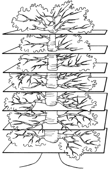
cosmic ceiba tree with its trunk planted on Earth reaching straight
upwards through circular holes made in seven heavenly celestial planes
that souls of the dead ascend according to merit. The Lenni Lenape
Native Americans even perform religious rituals in large tree houses
using living trunks as the central post to physically embody this
symbolism. To this day, many Mayan village centers have a single sacred
Ceiba tree growing due to these surviving ancient beliefs. They always
plant them within sight of the town hall, offer incense to them, elect
their mayors beneath them, and have done so for countless centuries.
"The
cosmic image of the ancient Nahua tribes of Texcoco, Chalco, and
Tlaxcala distinguished nine underworlds and as many heavens, while the
Aztec sometimes spoke of thirteen heavens. According to the original
concept, these heavens were the steps by which the sun ascended from
east to west during the morning, and by which he descended in the
afternoon in order to effect a parallel journey at night when passing
through the kingdom of the dead. In this way, the highest heaven and
the lowest underworld were not to be found at the end but in the center
of the two series of steps. The thirteen gods of the diurnal hours and
the nine gods of the nocturnal ones correspond to the steps or levels of
the heavens and of the underworld. The sun god reigns over the central
(seventh) hour of the day, and the god of death rules over the central
(fifth) hour of the night. Once again, spatial and temporal concepts
have been coordinated." -Walter Krickeberg
Anthropologist William
R. Holland wrote of the Maya, that they: "consider the heavens the home
of benevolent deities, creators and makers of all human, animal, and
vegetable life. Conversely, the lower world is the residence of evil
gods who eternally fight to undo the work of the heavenly gods and try
to win over new occupants for the world of the dead. Life is a constant
struggle between the forces of good and evil." In 1982 anthropologist
Peter Roe completed an exhaustive study of 105 Amazonian tribes and
found their cosmologies strikingly similar. He sumarized their
worldviews as follows: “There is a disk-shaped earth surrounded by
ocean. This disk is sandwiched between upper and lower worlds which are
often subdivided into several levels. There is also a world tree with
its roots in the underworld and its crown in the heavens.”
Yet
another example of this nearly ubiquitous concept is the Buddhist
sacred Bodhi Tree of Wisdom under which the Buddha was enlightened.
Nowadays associated with a local tree in India, the original legend of
the Bodhi Tree of Wisdom placed it at the center of the Earth, where it
helped Gautama Buddha pass over the celestial water to reach Nirvana.
When Buddha was unable to cross from one bank to the other, the spirit
of the Bodhi tree stretched its arms to aid him across, and then sitting
underneath the tree he gained enlightenment. In Buddhist art and
sculpture the Bodhi tree is often pictured with the "Chattra" umbrella
symbol above it. According to scholars Dr. William Warren and Gerald
Massey, this ornate parasol symbolizes the dome of the heavens and the
north polar home of the gods.
"The Paradise-tree of the Chinese
Tauists is also a World-tree. It is found in the centre of the
enchanting Garden of the Gods on the summit of the polar Kwen-lun. Its
name is Tong, and its location is further denned by the expression that
it grows 'hard by the closed Gate of Heaven.' As in many of the ancient
religions, the mount on which, after the Flood, the ark rested was
considered the same as that from which in the beginning the first man
came forth, it is not strange to find the tree on the top of the
mountain of Paradise remembered in some of the legends of the Deluge. In
the Tauist legend it seems to take the place of the ark. Thus we are
told that 'one extraordinary antediluvian saved his life by climbing up a
mountain, and there and then, in the manner of birds plaiting a nest,
he passed his days on a tree, whilst all the country below him was one
sheet of water. He afterwards lived to a very old age, and could testify
to his late posterity that a whole race of human beings had been swept
from the face of the earth. It is at least suggestive to find this same
idea of salvation from a universal deluge by means of a miraculous tree
growing on the top of the divine Mountain of the North among the Navajo
Indians of our own country. Speaking of the men of the world before our
own, and of the warning they had received of the approaching flood,
their legends go on: Then they took soil from all the four corner
mountains of the world, and placed it on top of the mountain that stood
in the North; and thither they all went, including the people of the
mountains, the salt-woman, and such animals as then lived in the third
world. When the soil was laid on the mountain, the latter began to grow
higher and higher, but the waters continued to rise, and the people
climbed upwards to escape the flood." -Dr. William Warren, “Paradise
Found: The Cradle of the Human Race at the North Pole” (274-5)
The
ancient Egyptians, Phoenicians, Persians, Greeks, Syrians and Assyrians
all had their own versions of a world tree as well. The Greek Winged
Oak of Pherecydes and the Holy Palm of Apollo in the Hyperborean Garden
of Hesperides were two stories of this sacred tree. The Egyptian Tree
of Life was located at the axis of Earth and was home to Bennu, the
sun-bird, who sat upon its branches. The Northwind from his polar perch
yielded a life-sustaining celestial rain upon the Earth and down to
Duat, the underworld. The Persian Zoroastrian tree grew atop the summit
of "Hara-berezaiti," the world's tallest mountain at the geographic
center-point of the universe, around which the stars revolved, and
behind which the Sun hid at night. It was home to "Ardvi-Sura," the
polar head-spring source of all waters, falling from heavenly rivers to
Earth before descending to the underworld.
"In our interpretation
the original river is from the sky; the division takes place on the
heights at the Pole, and the four resulting rivers are the chief streams
of the circumpolar continent as they descend in different directions to
the surrounding sea. Does such a view find any support in the
traditions of the ancient world? That it does will be clear to anyone
who has carefully read thus far. Let us take the rivers of the Persian
cradle of the race. Where do they rise? If the investigator of this
question have made no previous studies in Comparative Sacred
Hydrography, he will be surprised to find that in Persian thought, not
only the Paradise rivers, but also all the rivers of the whole earth,
have but one headspring and but one place of discharge. This head-spring
is the Ardvi-Sura, situated in heaven, the heaven of the Pole. 'This
heavenly fountain,' says Haug, summarizing the contents of the Aban
Yasht, 'has a thousand springs and a thousand canals, each of them forty
days journey long. Thence a channel goes through all the seven
keshvares, or regions of the earth, conveying everywhere pure celestial
waters.'" -Dr. William Warren, “Paradise Found: The Cradle of the Human
Race at the North Pole” (250-1)
These
concepts of celestial rainfall and heavenly rivers are found concurrent
with most World Tree myths. In the Mexican version, Tlaloc, the god of
water, lives atop the world's tallest mountain whence come all the
Earth's rains and streams. In the Indian version, the heaven-spring
Ganga falls upon Mount Meru, first watering the land of gods at the
pole, then flowing outward towards the cardinal points from four main
rivers into the Arctic ocean. The Hindu epic Mahabharata says the
head-spring exists in the highest heaven of Vishnu, high above the
highest star Druva (Polaris). During their descent the waters first
wash Druva, then the Seven Rishis (Big Dipper), and then fall atop Mount
Meru, where the heavenly Ganga river "divides into four mighty rivers,
flowing in opposite directions," and feeds the world's oceans.
"And
all this lays bare for us the origin of the Iranian and Hindu holiness
of water; 'river-water is everywhere throughout India held to be
instinct with divinity,' says Sir Monier Williams. Among primaeval
peoples, who observed the connection between the rains and the springs
and watercourses which were manifestly swelled by them, all waters
became of supernal origin, the gift of the heavens-god. And thus the
heavens-river, clearly discerned by the eye of faith in the heavens as
the Milky Way became the generation and sanctifier of all earthly
rivers. According to Josephus, the Ganges, Tigris, Euphrates and Nile
were but members of the one great ocean-River of the Greeks, which ran
about the whole earth; which Aristotle described as having its origin in
the upper heavens, descending in rain upon the earth, feeding, as
Hesiod, Homer, and Euripides said, all fountains and rivers, and every
sea; then branching out into the Rivers of the underworld, to be
returned fire-purged and sublimated to the upper heavens, there to
recommence its round." -John O’Neill, “Night of the Gods vol ii” (866)
The
ancient Greek poets also often alluded to this concept with "Okeanos,"
the great Earth encircling river. Homer wrote that Okeanos was where
"all rivers and every sea and all fountains flow." Hesiod in his
Theogony similarly wrote that "all rivers, as sons, and all fountains
and brooks, as daughters, are traced back to Okeanos." The Greek poets
personified Okeanos as a god, "the great sea-god who girdles the entire
world," or as Aeschylus wrote, "He who with his sleepless current
encircles the whole earth." Plato also wrote of Okeanos directly
connecting it with the four polar rivers in his Phaedo, stating, "among
the many are four streams, the greatest and outermost of which is that
called Okeanos, which flows round in a circle." And if any doubt
remains, Orphic Hymn 83 explicitly mentions the fountain at the Pole:
"Okeanos whose nature ever flows, from whom at first both gods and men
arose; sire incorruptible, whose waves surround, and earth's
all-terminating circle bound: hence every river, hence the spreading
sea, and earth's pure bubbling fountains spring from thee. Hear, mighty
sire, for boundless bliss is thine, greatest cathartic of the powers
divine: earth's friendly limit, fountain of the pole, whose waves wide
spreading and circumfluent roll. Approach benevolent, with placid mind,
and be forever to thy mystics kind."
The Chinese story of Mount
Kunlun and the Tong tree also features "T'ien Ho," the many channeled
river, or river of eight, which falls and separates at the pole. The
head-spring of these celestial waters and source of this mythology is
none other than that area of the heavens known to the ancients as the
Dark Rift, and better known to us as the Milky Way. In the Chinese
version, celestial rainfall from the Milky Way descends on the North
Pole separating into many channels including their sacred Yellow River,
which they see as a continuation of the T'ien Ho heavenly stream. Then
from there the many channels flow into the oceans transporting pure
heavenly waters across the entire world.
"However
named, all waters are simply portions of the same heaven-descending
stream. The other innumerable waters and rivers, springs and channels,
are one in origin with those, so in various districts and various places
they call them by various names. Even plant-sap, and blood, and milk,
are parts of the one cosmic current. All these, through growth, or the
body which is formed, mingle again with the rivers, for the body which
is formed and the growth are both one. Everything of a liquid nature,
therefore, in the whole world is conceived of as proceeding from one
source high in the north-polar sky. Into such a marvelously complete
cosmical circulatory water system did the Iranic imagination develop the
primitive head-stream of Eden. But never, even in the most extravagant
mythological adornments of the idea, was it for a moment forgotten that
the original undivided stream originates in the north polar sky; and
that its division into earthly streams and rivers is on the holy mount
which stands in the centre." -Dr. William Warren, “Paradise Found: The
Cradle of the Human Race at the North Pole” (254)
This
concept of "holy water" exists in nearly all of the world's religions
from Christianity, Islam and Sikhism, to Buddhism, Hinduism, and
Jainism. The Christian cross itself is the same shape as the 4 rivers
at the North Pole and before entering church the parishoner dips their
fingers in holy water and touches 4 points on their bodies. To bless
the water, the priest first makes the sign of the cross over the basin,
touches the surface with the palm of his hand, and says "I bless thee,
creature of water, by the God that made thee issue from the earthly
Paradise in four rivers." Christian baptism also takes place "ex aqua
et spiritu sancto," or "of water and of the holy spirit" where the holy
spirit is transported into the "born again" Christian through the medium
of water. In Buddhism monks similarly bless vessels of holy water then
use special wooden fans to sprinkle the water over temple-goers. In
Islam, followers drink or wash in water from their sacred "Zamzam" Well
in Mecca.
How could these detailed parallel mythologies and
concepts all rise and flourish independently of one another thousands of
years ago? What could be the origin and impetus of these ideas of
world trees, celestial rivers, and polar mountains if not their literal
existence? The next section will explore the metaphorical meanings of
these ancient allegories, how modern man can make sense of them, and why
this important information is so suppressed.
The
North Pole is the inherent geographical focal point of all creation.
It is the perfect center of the bullseye, the magnetic attractor of all
the world's compasses, the originator of all the world's tides, and home
to the only motionless star in the heavens, around which all the other
stars, the Sun, and the Moon revolve. In ancient times it was also
claimed to be home to the tallest mountain and the tallest people on
Earth. As recently as the 19th century, explorers like Olaf Jansen have
continued telling so-called "tall tales" of meetings with races of
giant human beings who live at the Pole.
In
his book "The Smoky God," Olaf Jansen claimed to have journeyed to the
North Pole with his father in 1829 where they met and mingled 2 years
with a race of 12 foot tall giants who lived up to 800 years, spoke a
language similar to Sanskrit, and inhabited a paradisical capital city
named "Eden." This particular story is most likely a piece of fiction,
but echoes a long-standing tradition of similar claims that the North
Pole is or was once home to a paradisical Edenic abode inhabited by
races of gigantic and/or miniature human beings.
In Heylin's 1659
book "Cosmographie," he states that on the North of Lappia and Biarmia,
near the Pole, lives a race of Pygmies, the tallest of which are not
above four feet high. Gerardus Mercator's 1595 polar map includes this
island of Pygmies with a caption mentioning their tiny four-foot
stature. Johannes Ruysch's 1508 world map also shows the many
surrounding polar islands claiming 2 of them inhabited, but without
mentioning the alleged inhabitant's size or stature. In the book "Gesta
Hammaburgensis Ecclesiae Pontificum," Archbishop Adalbert's team of
Frisian explorers told of encountering giant human beings living in
caves and underground hollows during their 1035 Polar expedition.
In
ancient Greek and Roman texts from Pindar, Herodotus, Hesoid and Homer,
to Virgil and Cicero, it was universally claimed that the North Pole
was home to a race of giants called the "Hyperboreans" who lived for
over a thousand years and enjoyed lives of perfect happiness.
Hyperborea was allegedly bathed in 24 hour sunlight with the Sun only
ever rising or setting once every year! Pliny the Elder wrote in his
Natural History book IV that, "The farthest of all, which are known and
spoke of, is Thule; in which there be no nights at all, as we have
declared, about mid-summer, namely when the Sun passes through the sign
Cancer; and contrariwise no days in mid-winter: and each of these times
they suppose, do last six months, all day, or all night."
For
observers standing at the Pole, the heavens would appear to have been
created just for them. Their unique perspective places Polaris, the
only motionless star in the sky, perfectly situated directly above them,
with all the other visible stars rotating horizontal left to right
paths 360 degrees around, all at an apparently equal distance away. The
Sun and Moon also rotate horizonally around the polar observer, with
the Sun rising and setting only once per year, creating 6 month days and
6 month nights!
"If an observer is stationed at the North
Pole, the first thing that will strike him is the motion of the
celestial sphere above his head. Living in the temperate and tropical
zones we see all heavenly objects rise in the east and set in the west,
some passing over our head, others traveling obliquely. But to the man
at the Pole, the heavenly dome above will seem to revolve round him,
from left to right, somewhat like the motion of a hat or umbrella turned
over one’s head. The stars will not rise and set, but will move round
and round, in horizontal planes, turning like a potter’s wheel, and
starting on a second round when the first is finished, and so on, during
the long night of six months. The sun, when he is above the horizon for
6 months, would also appear to revolve in the same way. The centre of
the celestial dome over the head of the observer will be the celestial
North Pole, and naturally enough his north will be over-head, while the
invisible regions below the horizon would be in the south." -Lokamanya
Bal Gangadhar Tilak, “The Arctic Home in the Vedas” (42)
For
polar observers the Sun rises in the South, not the East, and circles
horizontally around rising ever so slightly in the sky, about a quarter
degree per day. This creates an extended morning twilight with its
brilliant colors which instead of lasting for the usual 45 minutes,
lasts around 45 days! Every year at the spring equinox, after a long
winter night, dawn begins to break and the first traces of the Sun creep
above the horizon. By summer solstice the Sun reaches its highest
point in the polar sky, around 23.5 degrees, and begins its slow, almost
imperceptible descent. At the autumnal equinox, the last traces of the
Sun disppear beyond the horizon, and an extended evening twilight
persists for a month and half, after which the polar observer will not
see sunlight again until spring. Thanks to abundant starlight, regular
aurora borealis activity, and two weeks of moonlight per month, the long
polar nights are not pitch black, but actually quite well lit and
beautiful.
"We have stated that to an observer at the North
Pole, there will be a night of 6 months, and one is likely to infer
therefrom that there will be total darkness at the Pole for one half the
portion of the year. Indeed one is likely to contemplate with horror,
the perils and difficulties of a long night of six months, during which
not only the light but the warmth of the sun has to be artificially
supplied. As a matter of fact, such a supposition is found to be
erroneous. First of all, there will be the electric discharges, known as
Aurora Borealis, filling the polar night with their charming glories,
and relieving its darkness to a great extent. Then we have the moon,
which, in her monthly revolution, will be above the polar horizon for a
continuous fortnight, displaying her changing phases, without
intermission, to the polar observer. But the chief cause, which
alleviates the darkness of the polar night, is the twilight before the
rising and after the setting of the sun. The dawn in the tropical or
the temperate zone is but brief and evanescent, and it recurs after
every 24 hours. But still it has formed the subject of poetical
descriptions in different countries. If so, how much more the spectacle
of a splendid long dawn, after a darkness of two months, would delight
the heart of a Polar observer, and how he will yearn for the first
appearance of the light on the horizon." -Lokamanya Bal Gangadhar
Tilak, “The Arctic Home in the Vedas” (44-46)
In
all, a year at the Pole sees approximately six months of continuous
daylight, followed by a month and a half of evening twilight, then three
months of relative darkness, ending in a month and half long spring
dawn. The exact number of days for each portion of the polar year is
disputed among various authorities, however, which raises the question
again as to whether or not modern man truly has attained the Pole. If
we have research bases and encampments built all over at and around the
North Pole as claimed, why is there not a single video online or
anywhere else showing a year-long continuous time-lapse of this world
wonder!? To see Polaris unmoving directly 90 degrees overhead while all
the other stars rotate horizontally around uninterrupted by sunlight
for months at a time, then to watch the first rays of the longest, most
beautiful dawn lighting the horizon and revolving 360 degrees around
without setting for many more months, would be an absolute spectacle to
behold, worthy of an Imax documentary, and a true wonder of the world,
but somehow no such video exists.
“First of all appears low in
the horizon of the night-sky a scarcely visible flush of light. At first
it only makes a few stars’ light seem a trifle fainter, but after a
little it is seen to be increasing, and to be moving laterally along the
yet dark horizon. Twenty-four hours later it has made a complete
circuit around the observer, and is causing a larger number of stars to
pale. Soon the widening light glows with the luster of ‘Orient pearl.’
Onward it moves in its stately rounds, until the pearly whiteness burns
into ruddy rose-light, fringed with purple and gold. Day after day, as
we measure days, this splendid panorama circles on, and, according as
atmospheric conditions and, clouds present more or less favorable
conditions of reflection, kindles and fades, kindles and fades, — fades
only to kindle next time yet more brightly as the still hidden sun comes
nearer and nearer his point of emergence. At length, when for two long
months such prophetic displays have been filling the whole heavens with
these increscent and revolving splendors, the sun begins to emerge from
his long retirement, and to display himself once more to human vision.
After one or two circuits, during which his dazzling upper limb grows to
a full-orbed disk, he clears all hill-tops of the distant horizon, and
for six full months circles around and around the world’s great axis in
full view, suffering no night to fall upon his favored home-land at the
Pole. Even when at last he sinks again from view he covers his retreat
with a repetition of the deepening and fading splendors which filled his
long dawning, as if in these pulses of more and more distant light he
were signaling back to the forsaken world the promises and prophecies of
an early return.” -Dr. William Warren
You would think such a
sight would be worthy of recording, yet somehow, no one in history has
ever bothered to do so. If we have truly attained the North Pole and
have permanent and semi-permanent structures with people stationed at
and around there year-round, why in the flat world has no one ever
recorded an annual time-lapse of this incredible occurance?
The
polar 6 month day and 6 month night has been written about by diverse
cultures throughout history, many insisting that their ancestors or gods
were the original inhabitants. In the ancient Indian Vedas, the "day
of the gods," and "night of the gods," were each six months in duration,
and their gods lived atop Mount Meru at the North Pole. The Surya
Siddhanta XII, 67 states that "At Meru, Gods behold the sun after but a
single rising during the half of his revolution beginning with Aries,"
and the Institutes of Vishnu says, "The southern progress of the sun is
(with them) a night and a year is (with them) a day and a night." In
Norse mythology, it is claimed that before the present established order
of the world, their Sun rose in the South, which is what would have
been experienced by their polar ancestors. In ancient Iranian
mythology, Yima, the first man and King of the Golden Age lived in an
Edenic abode called Vara, where the Sun only rose and set once per year.
"A phenomenon like this cannot fail to be permanently
impressed on the memory of a Polar observer, and it will be found later
on that the oldest traditions of the Aryan race have preserved the
recollection of a period, when its ancestors witnessed such wonderful
phenomenon, — a long and continuous dawn of several days, with its
lights laterally revolving on the horizon, in their original home."
-Lokamanya Bal Gangadhar Tilak, “The Arctic Home in the Vedas” (46-7)
The
heavenly dome rotating perfectly horizontally overhead for polar
observers is another unique peculiarity of polar astronomy found in
ancient mythology. In Greek mythology, the gods rule from Mount Olympus
and as the Iliad states, "from the upper sky, the celestial dome in
which sun, moon and stars wheel silently around the Pole." In the Vedas,
Indra "supports the heavens as on a pole," and "upholds heaven and
earth, and turns the widest expanse, as the wheels of a chariot are held
by the axle." An imaginary line from the North Pole to Polaris, would
appear perfectly vertical and like a handle supporting the twirling
umbrella of the heavens, or an axis supporting the wheel of a chariot.
"If
we combine the two statements, that the heavens are supported as on a
pole and that they move like a wheel, we may safely infer that the
motion referred to is such a motion of the celestial hemisphere as can
be witnessed only by an observer at the North Pole. In the Rig-Vedas I,
24, 10 the constellation of Ursa Major (Rikshah) is described as being
placed “high” (uchhâh), and, as this can refer only to the altitude of
the constellation, it follows that it must then have been over the head
of the observer, which is possible only in the Circum-Polar regions."
-Lokamanya Bal Gangadhar Tilak, “The Arctic Home in the Vedas” (60-1)
In
the Mahabharata, during Arjuna's visit to Mount Meru, chapters 163 and
164 of the Vanaparvan state that, "At Meru, the sun and the moon go
round from left to right every day, and so do all the stars. The day
and the night are together equal to a year to the residents of that
place." The ancient Laws of Manu I, 67 state, "A human year is a day
and a night of the Gods; thus are the two divided, the northern passage
of the sun is the day and the southern the night." And the Taittiriya
Brahmana says, "That which is a year is but a single day of the Gods."
In
the collection of ancient Zoroastrian texts known as the "Avesta," the
Aryan Paradise, known as "Airyana Vaêjo" is described as a blissful
place where the Sun rose only once per year and was destroyed by
relentless snow and ice forcing the inhabitants, Earth's original
progenitors, to migrate southwards. This same idea that the first
humans devolved from God or gods at the North Pole is replete within
ancient scriptures, and starkly contrasts modern mainstream claims that
the first humans evolved from primates in Africa.
Two excellent
books were written on this subject, one by Boston University president
and professor Dr. William Warren entitled, "Paradise Found: The Cradle
of the Human Race at the North Pole," and another by the renouned Indian
teacher and activist Lokamanya Bal Gangadhar Tilak entitled, "The
Arctic Home in the Vedas." In both well-researched publications Warren
and Tilak present convincing arguments with abundant supporting evidence
suggesting that our most ancient ancestors lived at the North Pole and
spread outwards southwards from there likely due to climate changes.
"Our
hypothesis calls for an antediluvian continent at the Arctic Pole. It
is interesting to find that a writer upon the Deluge writing more than
forty years ago advanced the same postulate. Is the supposition that
there existed such a continent scientifically admissible? Until very
recently too little was known of the geology of the high latitudes to
warrant or even to occasion the discussion of such a question. Even now,
with all the contemporary interest in Arctic exploration, it is
difficult to find any author who has distinctly propounded to himself
and discussed the question as to the geologic age of the Arctic Ocean.
It will not be strange, therefore, if we have here to content ourselves
with showing, first, that geologists and paleontologists do not think
the present distribution of Arctic sea and land to be the primeval one ;
and secondly, that in their opinion, incidentally expressed, a
'continent' once existed within the Arctic Circle of which at present
only vestiges remain. Mr. Alfred Russel Wallace incidentally shows that
the facts of Arctic paleontology call for the supposition of a
primitive Eocene continent in the highest latitudes, a continent which
no longer exists. His language is, 'The rich and varied fauna which
inhabited Europe at the dawn of the Tertiary period as shown by the
abundant remains of mammalia wherever suitable deposits of Eocene age
have been discovered proves that an extensive Palearctic continent then
existed.' Another most eminent authority in Arctic paleontology, the
late Professor Heer, of Zurich, fully fifteen years ago arrived at and
published the conclusion that the facts presented in the Arctic fossils
plainly point to the existence in Miocene time of a no longer existing
polar continent. On another and more lithological line of evidence Baron
Nordenskjold, the eminent Arctic explorer, has arrived at the same
conclusion. Speaking of certain rock strata north of the 68th degree of
north latitude, he says, 'An extensive continent occupied this portion
of the globe when these strata were deposited.' Elsewhere he speaks of
this 'ancient polar continent' as something already accepted and
universally understood among scientific men." -William Warren, “Paradise
Found: The Cradle of the Human Race at the North Pole” (73)
"It
has been already stated that the beginnings of Aryan civilization must
be supposed to date back several thousand years before the oldest Vedic
period; and when the commencement of the post-Glacial epoch is brought
down to 8000 B.C., it is not at all surprising if the date of primitive
Aryan life is found to go back to it from 4500 B.C., the age of the
oldest Vedic period. There are many passages in the Rig-Veda, which,
though hitherto looked upon as obscure and unintelligible, do, when
interpreted in the light of recent scientific researches, plainly
disclose the Polar attributes of the Vedic deities, or the traces of an
ancient Arctic calendar; while the Avesta expressly tells us that the
happy land of Airyana Vaêjo, or the Aryan Paradise, was located in a
region where the sun shone but once a year, and that it was destroyed by
the invasion of snow and ice, which rendered its climate inclement and
necessitated a migration southward. These are plain and simple
statements, and when we put them side by side with what we know of the
Glacial and the post-Glacial epoch from the latest geological
researches, we cannot avoid the conclusion that the primitive Aryan home
was both Arctic and inter Glacial. The discovery of the intimate
relationship between Sanskrit and Zend on the one hand and the languages
of the principal races of Europe on the other, a complete revolution
took place in the views commonly entertained of the ancient history of
the world. It was perceived that the languages of the principal
European nations — ancient and modern — bore a close resemblance to the
languages spoken by the Brahmans of India and the followers of
Zoroaster; and from this affinity of the Indo-Germanic languages it
followed inevitably that all these languages must be the off-shoots or
dialects of a single primitive tongue, and the assumption of such a
primitive language further implied the existence of a primitive Aryan
people." -Lokamanya Bal Gangadhar Tilak, “The Arctic Home in the Vedas”
(1-2)
In 1786 Sir William Jones, a Supreme Court judge who could
speak 30 languages, gave his Third Anniversary Discourse to the Asiatic
Society where he declared that the similarities between Sanskrit,
Greek, Latin, German, Celtic and Persian languages could only be
explained on the hypothesis that they all shared a common parentage.
His contemporary, the German philosopher Hegel, compared the
consequences of Jones' revelation to the discovery of a whole new world
and his ground-breaking work on this subject established him as the
founder of comparative linguistics. Jones wrote that, "The Sanscrit
language, whatever be its antiquity, is of a wonderful structure; more
perfect than the Greek, more copious than the Latin, and more
exquisitely refined than either, yet bearing to both of them a stronger
affinity, both in the roots of verbs and the forms of grammar, than
could possibly have been produced by accident; so strong indeed, that no
philologer could examine them all three, without believing them to have
sprung from some common source, which, perhaps, no longer exists; there
is a similar reason, though not quite so forcible, for supposing that
both the Gothic and the Celtic, though blended with a very different
idiom, had the same origin with the Sanscrit; and the old Persian might
be added to the same family."
Scholar and renowned linguist
Charles Berlitz of Berlitz language schools spoke an amazing 32
languages and just like Sir William Jones, his life's research in
comparative linguistics led him to the inescapable conclusion that all
the world's languages must trace back to a single, lost, ancient
dialect. Berlitz actually wrote several books about Atlantis and
believed the primary language of the human race originated there. In my
previous book, "The Atlantean Conspiracy," I also included a large
section on Atlantean Etymology, showing how an inordinate number of
words and prefixes from languages worldwide share the exact same or
incredibly similar meanings and pronunciations, strongly suggesting a
common ancient eytmological ancestor.
Researcher and Author John
G. Bennett also wrote a paper entitled "The Hyperborean Origin of the
Indo-European Culture" in which he argues that ancient languages were
more advanced, have devolved into our current languages, and likely
originally trace back to a lost polar civiliazation. This idea has also
been promoted by esotericists like Helena Blavatsky, Rene Guenon, and
Julius Evola who all shared a belief in the Hyperborean, polar origins
of mankind. According to them, during a golden age humanity solidified
into this material realm and has since undergone devolution. Rather
than evolving from apes, they insist humanity has progressively devolved
into an apelike condition.
"It is admitted that many of the
present explanations of these traditions and legends are unsatisfactory,
and as our knowledge of the ancient man is increased, or becomes more
definite, by new discoveries in archaeology, geology or anthropology,
these explanations will have to be revised from time to time and any
defects in them, due to our imperfect understanding of the sentiments,
the habits and even the surroundings of the ancient man, corrected. That
human races have preserved their ancient traditions is undoubted,
though some or many of them may have become distorted in course of time,
and it is for us to see if they do or do not accord with what we know
of the ancient man from latest scientific researches. In the case of the
Vedic traditions, myths and beliefs, we have the further advantage that
they were collected thousands of years ago, and handed down unchanged
from that remote time. It is, therefore, not unlikely that we may find
traces of the primeval Polar home in these oldest books. If the Aryan
man did live within the Arctic circle in early times, especially as a
portion of the Rig-Veda is still admittedly unintelligible on any of the
existing methods of interpretation, although the words and expressions
are plain and simple in many places. Dr. Warren has quoted some Vedic
traditions along with those of other nations, in support of his theory
that the Arctic regions were the birth-place of the human race."
-Lokamanya Bal Gangadhar Tilak, “The Arctic Home in the Vedas” (39-40)
At
the turn of the 17th century, shortly after Queen Elizabeth's advisor
John Dee was corresponding with Gerardus Mercator regarding the Polar
magnetic mountain, Queen Elizabeth's personal physician and knighted
President of the College of Physicians, "Sir" William Gilbert, wrote his
Opus "De Magnete," in which he argued against the prevailing belief of a
polar magnetic mountain, claiming instead the Earth itself to be a
great magnet. Coming in the wake of the Copernican revolution, Gilbert's
new model in stark contrast to the long-held, now deemed "unscientific"
notion that compass needles were attracted to a loadstone mountain at
the Pole, proposed that the Copernican ball-Earth actually generated
magnetism from a hypothetical molten metal core, which caused a
constantly moving di-polar magnetic field over the globe.
To this day Gilbert's hypothesis remains pure speculation since
no one in history has ever come close to penetrating or perceiving the
supposed 3950 miles to the ball-Earth's core. In reality the deepest
drilling operation in history, the Russian Kola Ultradeep, after decades
of work and dozens of broken drills managed to penetrate only 8 miles
down, so the entire ball-Earth model taught in schools showing detailed
descriptions of a crust, outer-mantle, inner-mantle, outer-core and
inner-core layers are all purely speculative as we have never even
broken through beyond the crust. Furthermore, there is nowhere in nature
that molten metal retains any significant magnetic properties once
heated past the "Curie Point," let alone create some convoluted
constantly moving di-polar field as Gilbert claimed then and proponents
of the globe still maintain today.
Several
decades after Gilbert's De Magnete made its impression on the world,
another knighted president of the Royal Society, "Sir" Isaac Newton,
would write the influential "Principia Mathematica," where he proposed
the concept of "gravity" to account (among other things) for how people
could exist without falling off the under-side of Copernicus'
ball-Earth. Coincidentally (or perhaps conspiratorially) a couple
centuries later, it would be yet another royally knighted man, "Sir"
Ernest Shackleton of the Royal Navy, who would allegedly complete that
upside-down journey under the globe becoming the first person to reach
the so-called "Southern Magnetic Pole."
Back
when the Earth was perceived as a level plane, there was only one Pole,
the North Pole, directly below Polaris, which was both geographically
and magnetically the center-point of Earth. Due to the hypothetical
globe's hypothetical di-polar magnetic core, however, there suddenly
became new frontiers to discover. Not only did Earth have a geographic
North Pole in the Arctic, but now its geographic antipode, the South
Pole in the Antarctic. Since Gilbert's magnetic poles were caused by
perpetually shifting molten metal, there now also came into existence,
constantly moving Northern and Southern Magnetic Poles as well. And
lastly, Earth's magnetic field was claimed asymmetrical, so that the
constantly moving North/South magnetic poles were not even antipodal,
meaning a straight line drawn from one to the other failed to pass
through the geometric center of their globe. To account for this, two
more theoretical poles known as the Geomagnetic North and Geomagnetic
South Poles were also added into the convoluted mix.
With
this, after centuries of failed expeditions to the Pole, the first
decade of the 20th century would suddenly claim the discoveries of the
Northern Magnetic Pole, the Southern Magnetic Pole, and shortly
thereafter, both the Geographic and Geomagnetic North/South poles as
well. This turn of the century rush to the Poles was not without its
problems, however, and many explorer's supposed polar achievements
during this era are now regarded even by mainstream historians as being
riddled with fraud and falsehoods.
Before the alleged 20th century successes, many attempts were made to
reach the North Pole during the 19th century all of which failed. In
1827 knighted British Royal Navy Rear-Admiral "Sir" William Parry
reached a record 82°45′N latitude before being forced to turn back due
to impassable thick ice. In 1845 another knighted British Royal Navy
Officer "Sir" John Franklin and his ill-fated two-ship, 129-man crew all
died during their attempt at the Pole, after becoming stuck in the ice
and everyone subsequently succumbing to starvation, hypothermia,
tuberculosis, lead poisoning, zinc deficiency, and/or scurvy. In 1875
yet another knighted British Royal Navy Officer, in fact, the Knight
Commander of the Royal Order of Bath, Admiral "Sir" Albert Markham made
an attempt at the Pole, reaching a new record 83°20′N latitude before
turning back due to rampant scurvy and lack of equipment. In 1895
Norwegian explorers Fridtjof Nansen and Hjalmar Johansen made a record
breaking 86°14′N attempt before turning back because of lack of food and
supplies. Then in 1899 Duke of the Abruzzi, member of the Royal House
of Savoy, and Italian Navy Admiral Prince Luigi Amedeo set another
record just barely beating out the Norwegians reaching 86°34′N latitude
before becoming stuck in the ice and losing two fingers to frostbite.
Finally
on September 1st, 1909, Arctic explorer Frederick Cook became the first
person in modern times to claim attainment of the North Pole when he
cabled from the Shetland Islands after a 15-month trek back, alleging to
have reached the Pole on April 21st, 1908. That day the Evening Mail
headlined: "Dr. Cook Reaches North Pole," and the next day The New York
Herald headlined "The North Pole is Discovered by Dr. Frederick A. Cook,
Who Cables to the Herald an Exclusive Account of How He Set the
American Flag on the World's Top." The news sent America and the rest of
the world into a frenzy of media-fueled excitement hailing Cook as a
hero.
Meanwhile,
another Arctic explorer, U.S Navy Admiral Robert Peary happened to be
at that very moment traveling home from his own polar expedition. Just
five days after Cook's cable, on September 6th, 1909, Peary cabled from
Labrador that he too had recently "Nailed the American Flag to the
Pole," on April 6th, 1909, a year after Cook's claim. When informed of
Cook's news, Peary cabled that Cook's claim "should not be taken
seriously," as he just stood atop the Pole and found no trace of Cook or
anyone else having been there. On September 7th, The New York Herald
headlined, "Robert E. Peary, After 23 Year Siege, Reaches North Pole,"
but to Peary's utter disappointment his claim to be first to the Pole
was not widely accepted. Peary immediately sprang into action obtaining
and cabling confessions from Cook's Eskimo guides making the Evening
Telegram headline for September 8th, 1909, "Peary Quotes Eskimos as
Saying Cook was Not Out of Sight of Land," and with this began a heated
rivalry between two former friends and Arctic travel companions that
would eventually end with both men and their polar attainment claims
being completely discredited.
“The
claimed attainment of the North Pole generated enormous controversy and
acrimony. Both Cook and Peary boasted that they were the first to reach
the pole. Cook’s North Polar Expedition, which dates from July 3, 1907
to September 21, 1909 began from Gloucester, Massachusetts, and was
sponsored by John Bradley. Cook visited Etah in northwest Greenland and
then proceeded north to Anoritoq. Here he became convinced that he could
reach the North Pole. Subsequently he returned to Etah in order to
prepare for the journey, and solicited assistance from Inuit. They
advanced again to Anoritoq, and on February 19, 1908 set out for the
North Pole. Cook’s route took him and his men via Smith Sound to Cape
Sabine, to Flagler Bay, and then across Ellesmere Island to Bay Fiord.
From there they proceeded to Eureka Sound, and established a camp at
Cape Stallworthy, located at the northern extremity of Axel Heiberg
Island where most of his party remained. Cook himself set out for the
Pole with two Inuit, Ahwelah and Etukishook, two sledges and twenty-six
dogs. He insisted that he reached the North Pole on April 21, 1908.
Peary’s polar venture occurred between July 6, 1908 and September 21,
1909. It was sponsored by the Peary Arctic Club, and the party strived
to reach the North Pole from Ellesmere Island. Peary’s ships, the
Roosevelt and Erik, collected 22 Inuit men and 17 Inuit women in
addition to 246 dogs in northwest Greenland. Winter quarters were at
Cape Sheridan in northeast Ellesmere Island. After arriving there on
September 5, 1908, Peary transferred stores to Cape Columbia, located on
the north of the island, and the selected place from which the assault
on the Pole was to be made. Peary’s polar advance commenced in February,
1909. Support parties led by Bartlett, Borup, Marvin, Macmillan and
Godsell had the task of carrying provisions, establishing a trail, and
providing igloos for Peary and Henson who were to lead the assault on
the Pole. The support parties turned back. The last to do so was led by
Bartlett who retreated on April 1, 1909 from latitude 87.47N. Peary,
Henson and four Inuit continued their approach to the Pole, which they
claimed to reach on April 6, 1909. A Cook/Peary controversy resulted. On
September 2, 1909 Cook published his claim to have reached the Pole.
Peary’s rival claim was submitted four days subsequently.” -Paul
Simpson-Housley, “The Arctic, Enigmas and Myths” (120-1)
So
after centuries of unsuccessful ill-fated attempts at the Pole, within
the space of just 4 days, two American explorers claimed to be the first
successes. Cook's journal description of his heroic arrival at the Pole
reads more like a piece of poetic fiction than an actual experience,
however, which has raised questions from skeptics. He wrote, “Constantly
and carefully I watched my instruments in recording this final reach.
Nearer and nearer they recorded our approach. Step by step my heart
filled with a strange rapture of conquest. At last we step over colored
fields of sparkle, climbing walls of purple and gold - finally, under
skies of crystal blue, with flaming clouds, we touch the mark. The soul
awakens to a definite triumph; there is sunrise within us, and all the
world of night-darkened trouble fades. We are at the top of the world.
The flag is flung to the frigid breezes of the North Pole. The first
realization of actual victory, of reaching my lifetime’s goal, set my
heart throbbing violently and my brain aglow. I felt the glory which the
prophet feels in his vision, with which the poet thrills in his dream. I
saw silver and crystal palaces, such as were never built by man, with
turrets flaunting ‘pinions glorious, golden.’ The shifting mirages
seemed like the ghosts of dead armies, magnified and transfigured, huge
and spectral, moving along the horizon and bearing the wind-tossed
phantoms of golden blood-stained banners. I was at a spot which was as
near as possible, by usual methods of determination, five hundred and
twenty miles from Svartevoeg, a spot toward which men hand striven for
more than three centuries - a spot known as the North Pole, and where I
stood first of white men.”
Peary's
journal description of his arrival at the pole sounded more down to
Earth and believable, but doubt would soon be cast on his claims as
well. He wrote, “The Pole at last. The prize of three centuries. My
dream and goal for twenty years. Mine at last. I cannot bring myself to
realize it. It seems all so simple and commonplace. While we travelled,
the sky cleared, and at the end of the journey, I was able to get a
satisfactory series of observations at Columbia meridian midnight. These
observations indicated that our position was then beyond the Pole … in a
march of only a few hours, I had passed from the Western to the Eastern
Hemisphere and had verified my position at the summit of the world. It
was hard to realize that, on the first miles of this brief march, we had
been travelling due North, while, on the last few miles of the same
march, we had been travelling South, although we had all the time been
travelling precisely in the same direction. In travelling the ice in
these various directions, as I had done, I had allowed approximately ten
miles for possible errors in my observations, and at some moment during
these marches and countermarches, I had passed over or very near the
point where the North and South and East and West blend into one.”
Thus,
starting in September 1909 a huge public debate fueled by the
newspapers raged over who was truly first to the North Pole with The New
York Times showing unwavering support for Peary and The New York Herald
doing the same for Cook. The demand of proof in the form of
navigational records was issued and subsequently avoided by both sides.
Cook never produced any detailed original navigation records to
substantiate his polar claim, and on December 21, 1909, after examining
what little evidence Cook did submit, a commission at the University of
Copenhagen ruled there was no proof he had reached the Pole. Cook's
Inuit guides would also testify in hand-written documents that during
their final push for the Pole, they actually traveled South, not North,
and never once did they travel out of sight of land! Meanwhile Peary
outright refused to submit his records for the Copenhagen commission
forcing them to also conclude a lack of proof for his claim.
Cook
later alleged to have kept copies of his sextant navigation data and in
1911 published some, only to be exposed as having an incorrect solar
diameter during his calculations. The National Geographic Society held
Peary's papers for decades, refusing researchers any access to them, and
when finally independently examined, were also shown to be lacking. The
released documentation listed only three solar observations without
giving the date, no mention of which limb of the Sun Peary observed, and
claimed the star Betelgeux present when it could not have been detected
by a sextant during that time of year. Peary never produced records of
compass readings, observed data for steering, for his longitudinal
position at any time, and for the final stage in his expedition never
took latitudinal or transversal readings, and had no accompanying
colleagues trained in navigation who could confirm or deny his work.
Even though Cook's own navigational data was found to be flawed, he
would still publicly criticize Peary's alleged sextant readings stating,
“Mr. Peary’s polar claim rests upon the impossible observations of a
sun at an altitude of less than 7 degrees above the horizon. The three
armchair geographers, seldom out of reach of dusty book-shelves, passed
upon these worthless observations. Not one out of one hundred thousand
honest sextant experts would credit such an observation as that upon
which Mr. Peary’s case rests - not even in home regions, where for
centuries tables for corrections had been gathered.”
Not
only were Cook and Peary's testimonies dubious and navigational records
unsatisfactory, but the speeds claimed on their final pushes to the
Pole were also incredulous. Cook recorded on the fourth and fifth days
before his support party left, that even with full sledge loads, he was
able to traverse 29 and 22 miles respectively those days, around double
their usual distance covered, yet his Inuit guide Etukishook claimed
that they remained in the same place for two nights. Polar researcher
and author Randall Osczevski in his book "Frederick Cook and the
Forgotten Pole," wrote that, "Cook had needed to invent additional
mileage to make up the distance he said he had covered in reaching the
Pole, and to bring him back to land on a reasonable date. Some of this
padding is found in distances claimed for days when they did not travel,
but some could have been created by simply changing the units. Since
his mileage figures came from a pedometer, it is likely that he
originally recorded these figures as statute miles. Pretending that they
had really been nautical miles would add 15% to the distance."
Peary's
supposed speeds during his final push to the Pole were even less
believable than Cook's, allegedly averaging up to an implausible 71
miles per day. His last five marches while accompanied by experienced
navigator Captain Bob Bartlett averaged no more than 13 miles per day.
Once his last supporting party turned back and Captain Bartlett was
ordered southward, Peary's alleged speeds immediately doubled for the
next five marches. Then Peary claimed during the final eight days that
his speed quadrupled from a base camp to the Pole and back, covering 296
miles, 198 of them in just 4 days, giving an average of 49 miles a day.
This figure, however, is before factoring many more miles of admitted
detours due to navigation errors, drift, avoiding pressure ridges and
open water leads, which critics claim bring the figure closer to 71. No
other explorer before or since has ever claimed such ridiculous speeds.
Polar researcher and author Paul Simpson-Housley wrote in his "The
Arctic Enigmas and Myths," that, "those records fail to confirm that
Peary reached his goal, and such observations could certainly have been
faked. Peary fails to provide a detailed account in his diary. Moreover,
he should have presented a well-kept log of his final approach that
included checks on compass variation and on his latitude and longitude
made by providing altitudes of the sun, planets and stars at various
locations. Polar pack-ice is difficult terrain to traverse. The
ice-drift deviates from wind direction to the right by 28 degrees to 30
degrees in the northern hemisphere at a speed of 1/50 of the wind
forcing it. Peary provided no wind speeds in either his diary or
published reports. It is highly likely that he would be propelled to the
left of his 70 degree meridian. His desire to reach the Pole was
certainly in excess of his intent to produce records. In addition,
Peary’s chronometer displayed an error of ten minutes and this would
have influenced his heading."
More
doubt would eventually be cast on both Cook and Peary through public
scrutiny. In 1906 Cook had previously claimed himself the first man to
reach the summit of the tallest mountain in North America, Mount
McKinley, only to be dethroned upon further investigation. It turned out
the picture Cook provided as proof of his summit attainment was
actually taken on a small outcrop on a ridge beside the Ruth Glacier, 19
miles away, and at only 5,338 feet high, nearly 15,000 feet lower than
McKinley's true peak! Cook's sole companion during the 1906 climb, Ed
Barrill, would also later sign an affidavit admitting that they had not
reached the summit, including a map showing the location of what would
become known as "Fake Peak," where Cook's picture was actually taken.
Belmore Browne, an experienced mountaineer who assisted Cook in the
weeks before his alleged summit achievement, claimed McKinley too
expansive and treacherous to have allowed Cook such quick access in the
time frame given. He would later call Cook untrustworthy, and state for
the record that he, "knew that Dr. Cook had not climbed Mount McKinley
the same way a New Yorker would know that no man could walk from the
Brooklyn Bridge to Grant's tomb in ten minutes." Decades later Cook
would also be indicted and eventually charged and found guilty of 14
counts of fraud for startup oil companies he promoted and was sentenced
to 14 years, 9 months in prison.
As
for Peary, his obsession with the Pole caused him in the first 23 years
of his marriage to spend only 3 with his wife and family, missing the
birth and tragic death of his son. While in the Arctic, Peary cheated on
his wife with a 14 year-old Inuit girl named Aleqasina who would
eventually bear him two children named Kaala and Karree. During Peary's 7
long Arctic expeditions made between 1886 and 1909, a black man named
Matthew Henson was technically more responsible for their successes than
Peary himself. Henson took care of the other men, dogs and supplies,
spoke the Inuit language, pulled and fixed the sledges, and Henson even
drag Peary himself around during their final expedition since Peary had
lost 8 toes to frostbite on their previous journey and could barely
walk. Even still, Peary had secretly planned to leave Henson and the
Inuit guides behind for the final stint so that he could claim the Pole
solely for himself. His plan never came to fruition, however, and upon
realizing he would have to share the fame, Peary immediately stopped
speaking to Henson, the man who had engineered his success, saved his
life on a previous expedition, and remained unwaveringly loyal to him
for over two decades. As Peary had once written in a letter to his
mother, "I must be the peer or superior of those about me to be
comfortable." Historian Fergus Fleming called Peary, "the most
unpleasant man in the annals of polar exploration," and polar researcher
and author Beau Riffenburgh wrote that, "He was perhaps the most
self-serving, paranoid, arrogant, and mean-spirited of all
nineteenth-century explorers. He was suspicious of and hateful to those
he considered rivals either in actual geographical discovery or as
heroic figures. He was condescending and insensitive to his
subordinates, and he was ingratiating and servile to those he felt could
help his quest for personal glory."
Another
man preparing for a North Pole expedition in 1909 was accomplished
Norwegian explorer Roald Amundsen. Upon hearing word of Cook and Peary's
alleged successes, however, Amundsen decided to turn his attention
towards the Antarctic and the South Pole instead. Unsure his patrons and
crew would accept this change in plans, for the next two years Amundsen
lied to everyone about his true destination, telling even his entire
crew that they were traveling North to the Arctic Pole right up until
their ship "The Fram" was departing from their final port of call,
Madeira, when he let everyone know they would actually be going to the
Antarctic in search of the South Pole. After some initial
insubordination ultimately everyone went ahead with his drastic change
of plans. Upon reaching Antarctica, Amundsen brought 5 men and 52 dogs
with him for the final push to the Pole, and instead of bringing enough
food along for everyone, Amundsen had his team kill and eat over half of
the dogs used to carry them there. On December 14th, 1911 they would
allegedly reach the Geographic South Pole to be confirmed by Robert
Falcon Scott of the British Royal Navy who just happened to be in the
Antarctic about to launch his own polar expedition. Just one month after
Amundsen's alleged attainment of the South Pole, Scott's team already
en route would arrive and confirm Amundsen's claim.
The
problem with Amundsen, Scott, and all subsequent South Polar claims,
however, is the following: On the globe-Earth model, the Geographic
South Pole is located at 90 degrees South latitude where all 360 degrees
of longitude converge to one hypothetical point in the middle of an
Antarctic continent. In reality though, the Antarctic is not a
continent, but an encircling icy perimeter of unknown length, and on our
planar Earth, lines of longitude only converge upon the North Pole
center-point and project out straight southwards from there. One degree
of latitude is approximately 68 miles and the Antarctic ice begins
around 70 degrees South latitude (depending on access point), therefore
no matter what meridian of longitude followed, after traveling South
across the ice significantly far enough to the 90 degree mark (several
hundred miles), the "Pole" has been achieved. In other words, the
so-called "Geographic South Pole" is just an arbitrary point in the
Antarctic, along any line of longitude, significantly far enough south,
where all lines of longitude on the globe converge and become 0 degrees.
For ease of transportation, supplies and navigation, all South Pole
explorers just retrace their paths back to their boats, though if Earth
was truly shaped like a ball, conceivably they should be able to simply
continue a straight line path and come out the other side of Antarctica.
No explorer on foot or by air has ever done such a South-North
circumnavigation however because it is impossible, as the Earth is not a
globe.
For
posterity Roald Amundsen would be credited not only with being first to
the Geographic South Pole, but also first to winter in the Antarctic,
and then subsequent expeditions to the Arctic would claim for him titles
of first through the Northwest Passage, first to cross and first to
circumnavigate the Arctic Ocean, first to the Ice Pole (the Arctic Ocean
point farthest from land-masses), and after widespread distrust and
dispute of Cook/Peary's claims, a 1926 expedition would see Amundsen
reclaim being first to the Geographic North Pole as well!
Reminiscent of the 1909 Cook/Peary controversy, however, a similar
media-fueled heated debate raged in 1926 as U.S. Admiral Richard Byrd
allegedly reached the Pole by plane just 3 days before Roald Amundsen
did by dirigible! Both Byrd and Amundsen were aware of each other's
concurrent expeditions, and due to recent advances in aviation
technology, both decided to reach the Pole via air rather than land/sea
as previous explorers attempted. Similar to Scott's follow-up
confirmation of Amundsen's South Pole claim, the plan was for Admiral
Byrd to fly over first and dump a load of hundreds of large American
flags directly at the Pole, which Amundsen would then find and confirm a
few days later during his own polar flight.
So
on May 9th, 1926 Byrd and his co-pilot departed in their Fokker
tri-motor airplane, "The Josephine Ford," from the Norwegian island
Spitzbergen and attempted to fly over the Pole. Just 15 hours and 57
minutes later, including an alleged 13 minutes of circling the Pole,
Byrd landed back at Spitzbergen claiming to have reached the Pole and
traveled a distance of 1,535 miles. Upon return to the United States,
Byrd became a national hero, promoted to the rank of Commander, and was
awarded a Presidential Medal of Honor at the White House. Roald
Amundsen's airship "the Norge," allegedly floated over the Pole 3 days
later on May 12th, but was unable to confirm Byrd's attainment, because
Byrd never ended up dropping his cargo of U.S. flags over the Pole, nor
provide a public explanation of why.
At
first Byrd's polar claim was widely accepted and Amundsen reduced to
second-fiddle, but after new evidence came to light, and further
investigations made clear, Byrd never dropped the flags because he never
actually reached the Pole. The first public skepticism of Byrd began a
year after his death in 1958 when Byrd's colleague, personal pilot
during his South Pole flight, and helper in Spitzbergen for the North
Pole flight, Bernt Balchen, published his book "Come North With Me,"
which questioned the feasibility of Byrd's 1926 polar claim.
Essentially,
Byrd's sextant-locked 61 knot mean-speed for the first 6 1/4 hours of
the flight, per his own records in a recorded 7:07 GCT sextant shot,
required that to reach the Pole at the reported time he would need to
have suddenly after taking the reading jumped his average speed over
double from 61 to an implausible 148 knots in order to cover the final
284 miles in the alleged time allotted. In addition, once supposedly
reaching the Pole and circling around it for 13 minutes, his written
calculations contradictorily still claimed constant 85mph straight-line
speed northward. Apologists and defenders of Byrd dismissed Balchen's
objections insisting prevailing winds may have helped him along, until
in 1960 Gosta Liljquist, Professor of Meteorology at University of
Uppsala, examined the meteorological records and concluded there were
absolutely no polar winds strong enough on May 9th, 1926 to propel Byrd
so swiftly to his destination.
Another
exposure of Byrd's hoax surfaced in 1971 with Richard Montague's book
"Oceans, Poles, and Airmen," in which he interviewed Bernt Balchen, who
claimed that Floyd Bennet, Byrd's North Pole co-pilot had confessed to
him before his death that the Josephine Ford had actually developed an
oil leak early in the flight, lost a motor several hundred miles from
the Pole, and subsequently turned back circling out of sight of land
without making an effort to reach the Pole.
The final nail in Byrd's coffin came with the 1996 release of his
personal diary and papers recording the May 9th, 1926 flight. His
official sextant reading typewritten in his June 22nd report to the
National Geographic Society taken at 7:07:10 GCT claimed a solar
altitude of 18°18'18". In his diary however, an erased but still legible
recording shows his apparent observed solar altitude at 7:07:10 to have
been 19°25'30". Not only this, but a scrap piece of paper found in
Byrd's diary, also in his hand-writing, shows a third scribbled solar
altitude for 7:07:10 as being 18°19'18". This intermediate scrap paper
calculation between the diary recording and official typewritten report
shows evidence of gradual doctoring of the raw data in an effort to
fudge a believable figure. In addition, Byrd's official recorded sextant
data was overly precise far beyond the capabilities of his or any other
sextant available at the time. Dead-reckoning latitudes were recorded
with 1000 times better precision than physically possible, again
pointing towards an attempt to over-compensate the perceived accuracy of
his inaccurate fudged data.
To
summarize, Byrd's 1926 primary record includes several mysterious
erasures, back and forth diary entries, confirmed fabrications and
contradictions including two takeoff times, three Pole-arrival times and
7:07 sextant altitudes, and four different speeds! In documents
including his diary from the time we see intermediary steps of his
forging calculations for the most believable and accurate times, air
speeds, distances, and solar altitudes. He never dropped the cargo of
U.S. flags as intended and could not have attained the Pole at the
speeds recorded.
"In
brief: Byrd's diary and his typescript describe two quite different
trips. Indeed, there are actually FOUR distinct trips, because the diary
has three separate and contradictory sections: the sextant-observations
are for a 70mph celestially-navigated trip; the radioed distances are
for an 80mph dr trip; while the last-minute dr data are for an 85mph
trip. But the later neat typescript claims that the mean northward speed
was over 90mph. The typescript trip does not agree with ANY of the
three disparate diary trips. If you are caught keeping two sets of
fiscal books, you go to jail. Not even the wildest defense lawyer would
try alibiing the accused by treating the differences between the two
documents as exculpatory or mysterious when the whole point of the
indictment IS the discrepancies. Question: did any other explorer in
history leave us manuscript astronomical observations for position which
grossly to his disadvantage invariably differed from his published
observations?" -Dennis Rawlins, "Amundsen: Cheated and Uncheated"
Since Cook, Peary and Byrd's North Pole claims have all been found
fraudulent, it is now generally accepted that Roald Amundsen's dirigible
flight of May 12th, 1926 did cross the Pole, and he is credited with
being the first explorer to both the South and North Poles. Even
Wikipedia states that, "three prior expeditions led by Frederick Cook
(1908, land), Robert Peary (1909, land) and Richard E. Byrd (1926,
aerial) – were once also accepted as having reached the Pole. However,
in each case later analysis of expedition data has cast doubt upon the
accuracy of their claims." This is also Irish journalist Anthony
Galvin's conclusion in his book, “The Great Polar Fraud: Cook, Peary and
Byrd - How Three American Heroes Duped the World into Thinking They Had
Reached the North Pole.”
Ever
since Amundsen's dirigible "the Norge" allegedly successfully floated
over the Pole, many more explorers have also continued the legacy. Norge
designer and pilot Umberto Nobile along with several scientists and
crew allegedly crossed the Pole a second time on May 24th, 1928 in the
airship "Italia," which crashed before returning killing half the people
onboard. In May 1937 the Soviet government established the world's
first North Pole ice station allegedly just 13 miles from the Pole.
Interestingly enough, this station was found by ice-breakers just 9
months later off the Eastern coast of Greenland, over 1700 miles away!
This was explained as being caused by swift "ice drifts," which
radically displaced them. In May 1945 David Cecil McKinley of the Royal
Air Force claimed to flyover both the Geographic and North Magnetic
Poles. The Soviet "Sever 2" expedition in May 1948 claimed to set foot
on the Pole, and in May 1949 Soviets Vitali Volovich and Andrei Medvedev
claimed being first to parachute to the Pole. In May 1952 U.S. Air
Force Lieutenants Joseph Fletcher and William Benedict claimed the first
aerial landing at the Pole. The U.S. Navy submarine U.S.S. Nautilus
allegedly crossed the Pole in August 1958, and in March 1959 the U.S.S.
Skate claimed first to surface at the Pole, breaking through the ice
above it. An April 1969 British Trans-Arctic expedition claimed first to
reach the North Pole by foot, August 1977 the Soviet icebreaker Arktika
claimed first surface ship to reach the Pole, and on the list of
alleged polar firsts continue from first by dogsled to first by
motorcycle! In 1985, for a particularly interesting media-hyped "first,"
Sir Edmund Hillary, the first man to stand on the summit of Mount
Everest, and Neil Armstrong, the alleged first man to stand on the Moon,
claimed to land a small twin-engine ski plane and stand together at the
North Pole.
As
is abundantly clear to anyone who has objectively studied the NASA
Apollo missions, Freemason Neil Armstrong most certainly did NOT land on
the Moon, so it is fair and wise to be skeptical of whether he and his
royally knighted colleague "Sir" Edmund Hillary actually stood foot on
the Geographic Pole as well. As for the Magnetic Poles, the North was
allegedly discovered by James Clark Ross in 1831 at the Boothia
Peninsula, named after his father's patron "Sir" Felix Booth. This
peninsula located at 70 degrees North latitude, however, strangely
placed the Magnetic Pole well over a thousand miles from the Geographic
Pole. Roald Amundsen during his 1903 Arctic expedition was also credited
with discovering a new position of the Magnetic North Pole just 30
miles north from where Ross claimed. It was later in 1947 allegedly
found again by Canadian government scientists Paul Serson and Jack
Clark, of the Dominion Astrophysical Observatory, who claimed the Pole
had moved near Prince of Wales Island at 72 degrees North latitude.
Since then the North Magnetic Pole has continued to be "discovered" time
and again at random places in the Arctic following no discernable
pattern. Likewise the South Magnetic Pole was first allegedly discovered
by "Sir" Ernest Shackleton during his 1909 expedition, and has ever
since been found randomly moving all over the Antarctic.
The idea of constantly randomly moving Magnetic Poles divorced from
their Geographic counter-parts makes it conveniently impossible to
independently confirm or deny polar claims by compass. In other words,
since the invention of the video camera, any claim to have found the
North or South Magnetic Pole, can and should be easily proven. By
holding a compass and walking in a circle around the North Pole, the
compass should always point directly towards it, and by walking in a
circle around the South Pole, the compass should always point 180
degrees away in the opposite direction. To this day, however, no such
simple experiment has been performed to prove to the public that these
are truly magnetic poles at all.
Similarly,
there are no videos from the Geographic Poles that provide the public
with any concrete evidence that they are anywhere but some indistinct
undisclosed snowy tundra. North Pole documentaries always show some man
with an icicle mustache and a Garmin counting up their GPS latitude
until reaching 90 degrees. There are never stellar readings made showing
Polaris exactly 90 degrees above. There is no footage of the 6 months
of constant day and 6 months of constant night supposed to exist at the
Pole. GPS, the "Global" Positioning System, is based on a non-existent
"globe" and created by the U.S. Military, so why should we trust that a
GPS 90 degree north reading is truly the North Pole?
Why are the annals of Polar exploration so abundant with frauds and
hoaxes? Why should we accept all these more recent Polar claims as being
legitimate when the original discoveries and discoverers continue being
exposed as false and liars? Why is there such an inordinate number of
royal knights and Freemasons involved in Polar exploration? Admiral Byrd
himself was a high-ranking Freemason from Federal Lodge No. 1 in
Washington D.C. and financed by none other than fellow 33rd degree
Freemason and Illuminati bloodline elite John D. Rockefeller. Roald
Amundsen even had Masonic lodge No. 6-48 in Sacramento, California named
after him.
If these explorers truly reached the North Pole, then
where is the magnetic mountain, encircling whirlpool, four directional
rivers, and surrounding inhabited islands mentioned by Adam of Bremen,
Paul the Deacon, Gerald of Wales, Guido Guinizelli, Nicholas de Lynn,
Jacobus Cnoyen, Gerard Mercator, John Dee, the Hindus, Buddhists, Jains,
Shinto, Taoists, Jews, Christians, Muslims, the Norse, the Egyptians,
the Persians and literally every single ancient culture on Earth? Are
these all to be discounted as completely false stories with no factual
impetus? And if the polar magnetic mountain truly is just fanciful
mythology and non-sense, how do we account for this same ("false")
concept originating and flourishing independently in nearly every
ancient culture worldwide?